Approximate Location Map
Large Map »
Latitude: 53.9643 / 53°57'51"N
Longitude: -2.0365 / 2°2'11"W
OS Eastings: 397705
OS Northings: 452025
OS Grid: SD977520
Mapcode National: GBR GQ6L.XN
Mapcode Global: WHB77.PMG8
Plus Code: 9C5VXX77+PC
Entry Name: Aireville Lodge
Listing Date: 2 March 1978
Grade: II
Source: Historic England
Source ID: 1157299
English Heritage Legacy ID: 323449
ID on this website: 101157299
Location: Rockwood, North Yorkshire, BD23
County: North Yorkshire
District: Craven
Civil Parish: Stirton with Thorlby
Built-Up Area: Skipton
Traditional County: Yorkshire
Lieutenancy Area (Ceremonial County): North Yorkshire
Tagged with: Gatehouse
1.
5336 GARGRAVE ROAD
Aireville Lodge
SD 95 SE 2/51
II
2.
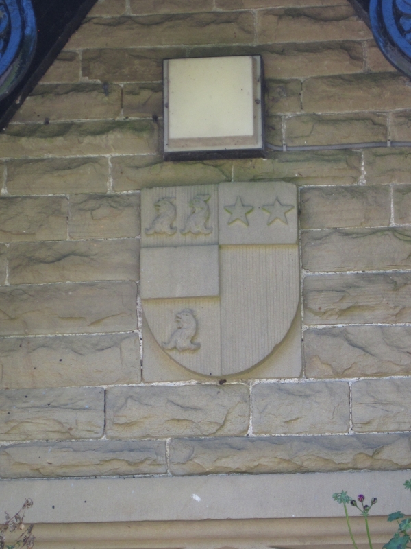
Circa 1836. Was originally the lodge to Aireville Hall. Single storey, stone,
with steep slate roof and tall chimney. Tudor doorway with shield of arms in
the gable above, with carved and shaped bargeboards. 2-light windows with moulded
stone mullions and small leaded panes. An oriel window facing the road.
Listing NGR: SD9770552025
External links are from the relevant listing authority and, where applicable, Wikidata. Wikidata IDs may be related buildings as well as this specific building. If you want to add or update a link, you will need to do so by editing the Wikidata entry.


Other nearby listed buildings
