Latitude: 52.1774 / 52°10'38"N
Longitude: -3.1006 / 3°6'2"W
OS Eastings: 324839
OS Northings: 253804
OS Grid: SO248538
Mapcode National: GBR F2.4TTM
Mapcode Global: VH77F.6JQP
Plus Code: 9C4R5VGX+WQ
Entry Name: Remains of Huntington Castle
Listing Date: 16 October 1967
Grade: II
Source: Historic England
Source ID: 1157544
English Heritage Legacy ID: 150665
ID on this website: 101157544
Location: Huntington, County of Herefordshire, HR5
County: County of Herefordshire
Civil Parish: Huntington
Traditional County: Herefordshire
Church of England Parish: Huntington
Church of England Diocese: Hereford
Tagged with: Architectural structure
HUNTINGTON CP HUNTINGTON SO 25 SW 1/110 Remains of Huntington Castle 16.10.67 - II
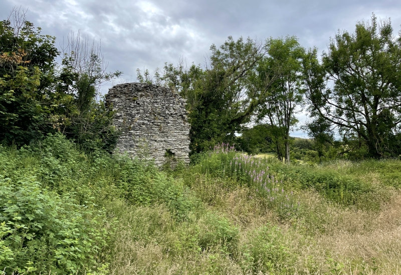
Castle remains. C13, or earlier origins, repaired in 1403, abandoned in 1460 (although one tower still in use as prison in 1521). Sandstone rubble. Earthworks consist of a motte 40 yards in diameter and three feet high with an oval inner bailey to the north-east and a crescent-shaped outer bailey also to the north-east. The inner bailey is approached by a causeway on the east side which probably marks the site of a former gate- house. The bailey was enclosed by a curtain wall; one fragment of this wall survives to the west about 20 feet high. Also part of a C13 tower remains to the north with a small chamber in the adjoining section of curtain wall. This chamber has traces of a window and two small recesses in the west wall. In the south part of the tower are the remains of a stair- case or corridor. The castle was in the possession of the Braose, Bohun and Stafford families during the Middle Ages. Ancient Monument County no 98. (RCHM, III, p 75-6, item 2; BoE, p 198).
Listing NGR: SO2483953804
External links are from the relevant listing authority and, where applicable, Wikidata. Wikidata IDs may be related buildings as well as this specific building. If you want to add or update a link, you will need to do so by editing the Wikidata entry.


Other nearby listed buildings