Latitude: 51.9428 / 51°56'33"N
Longitude: -2.88 / 2°52'47"W
OS Eastings: 339607
OS Northings: 227506
OS Grid: SO396275
Mapcode National: GBR FC.MVMC
Mapcode Global: VH78Q.1FBJ
Plus Code: 9C3VW4VC+42
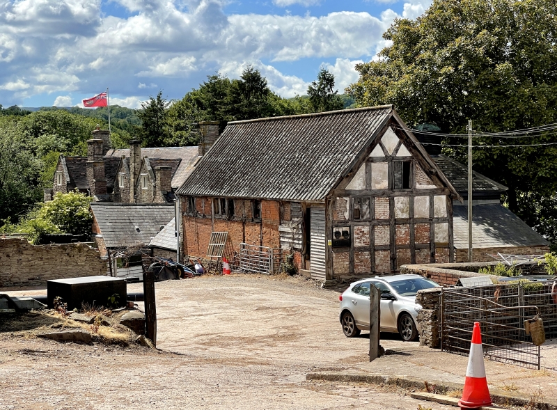
Entry Name: Barn Approximately 30 Metres South-West of Court Farmhouse
Listing Date: 20 May 1987
Grade: II
Source: Historic England
Source ID: 1157685
English Heritage Legacy ID: 155561
ID on this website: 101157685
Location: Pontrilas, County of Herefordshire, HR2
County: County of Herefordshire
Civil Parish: Kentchurch
Built-Up Area: Ewyas Harold
Traditional County: Herefordshire
Lieutenancy Area (Ceremonial County): Herefordshire
Church of England Parish: Kentchurch
Church of England Diocese: Hereford
Tagged with: Barn
KENTCHURCH CP PONTRILAS SO 32 NE 4/27 Barn approximately 30 m south-west of Court Farmhouse
GV II
Barn. Late C17 or early C18. Timber-framed with sandstone rubble plinth and brick infill, partly painted. Corrugated asbestos roof. Four bays aligned north-east/south-west with four irregular square headed openings. Three square panels from sill to wall-plate, V-struts in gables. Included for group value [with Pontrilas Court (qv)]. Court Farmhouse is not included in this list.
Listing NGR: SO3960727506
External links are from the relevant listing authority and, where applicable, Wikidata. Wikidata IDs may be related buildings as well as this specific building. If you want to add or update a link, you will need to do so by editing the Wikidata entry.


Other nearby listed buildings