Latitude: 54.7759 / 54°46'33"N
Longitude: -1.5853 / 1°35'7"W
OS Eastings: 426774
OS Northings: 542414
OS Grid: NZ267424
Mapcode National: GBR KFC6.LR
Mapcode Global: WHC4Q.M791
Plus Code: 9C6WQCG7+9V
Entry Name: Colpitts Hotel
Listing Date: 16 October 1975
Grade: II
Source: Historic England
Source ID: 1159164
English Heritage Legacy ID: 110068
ID on this website: 101159164
Location: Durham, County Durham, DH1
County: County Durham
Electoral Ward/Division: Neville's Cross
Parish: City of Durham
Built-Up Area: Durham
Traditional County: Durham
Lieutenancy Area (Ceremonial County): County Durham
Church of England Parish: Durham St Margaret of Antioch
Church of England Diocese: Durham
DURHAM AND FRAMWELLGATE ALEXANDRA CRESCENT NZ 2642 SE (West side)
13/26 Colpitts Hotel 16.10.75 GV II
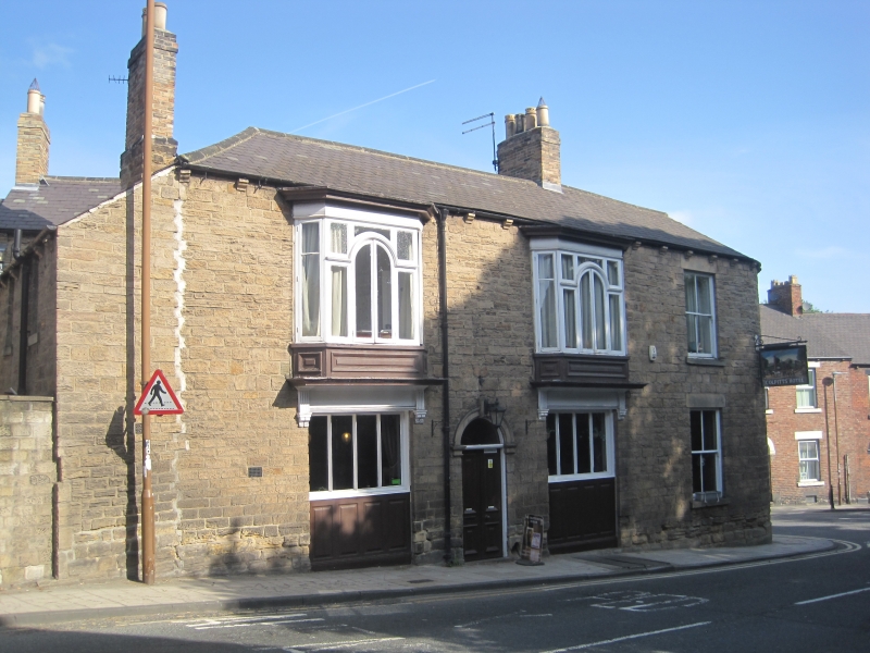
Public house. Circa 1836, Coursed squared sandstone with ashlar dressings; Welsh slate roof with yellow brick chimney. 2 storeys, 4 bays. 4-panelled double door and fanlight under bracketed keyed arch in second bay flanked by windows of 4 vertical lights over 4 wood panels. Ipswich-type glazing bars, and pulvinated frieze and cornice, to 2 oriels above with raised fielded panels on lower parts. Fourth bay has late C19 sashes with flat stone lintels and projecting stone sills. Stone gutter brackets. Roof rounded at right over corner. Boot-scraper beside door.
Listing NGR: NZ2676742366
External links are from the relevant listing authority and, where applicable, Wikidata. Wikidata IDs may be related buildings as well as this specific building. If you want to add or update a link, you will need to do so by editing the Wikidata entry.


Other nearby listed buildings