Latitude: 54.7773 / 54°46'38"N
Longitude: -1.5848 / 1°35'5"W
OS Eastings: 426802
OS Northings: 542570
OS Grid: NZ268425
Mapcode National: GBR KFC6.P7
Mapcode Global: WHC4Q.M5JY
Plus Code: 9C6WQCG8+W3
Entry Name: Railway Viaduct and Drinking Fountain Attached
Listing Date: 19 February 1970
Last Amended: 10 March 1988
Grade: II*
Source: Historic England
Source ID: 1322851
English Heritage Legacy ID: 110337
ID on this website: 101322851
Location: Durham, County Durham, DH1
County: County Durham
Electoral Ward/Division: Neville's Cross
Parish: City of Durham
Built-Up Area: Durham
Traditional County: Durham
Lieutenancy Area (Ceremonial County): County Durham
Church of England Parish: Durham St Margaret of Antioch
Church of England Diocese: Durham
Tagged with: Drinking fountain Railway viaduct
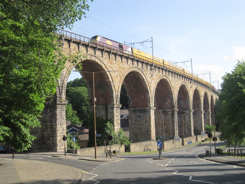
DURHAM AND FRAMWELLGATE NORTH ROAD NZ 24 SE 4/285 Railway viaduct and 19.2.70 drinking fountain attached (formerly listed as Durham Viaduct)
GV II*
Railway viaduct and fountain. Viaduct 1857 probably by TE Harrison for North Eastern Railway Co; fountain dated 186 and illegible digit. Rock-faced sandstone viaduct with ashlar dressings; brick soffits. Fountain sandstone with grey granite back plate and pink granite shafts. Viaduct: 100 ft. high; 11 arches. Tapered piers with coped plinths support round arches; continuous drip string. Parapet altered except over end piers, where it is flat-coped.
Gothic-style fountain on south face of pier to west of North Road has shouldered surround enclosing small 2-centred arch at base. Shafts above support gabled canopy with nail-head moulding and containing scroll with illegibel inscription and date. Stepped gabled surround has blind trefoils under each step; crocketed coping.
Listing NGR: NZ2680242570
External links are from the relevant listing authority and, where applicable, Wikidata. Wikidata IDs may be related buildings as well as this specific building. If you want to add or update a link, you will need to do so by editing the Wikidata entry.


Other nearby listed buildings