Approximate Location Map
Large Map »
Latitude: 51.9405 / 51°56'25"N
Longitude: -0.478 / 0°28'40"W
OS Eastings: 504719
OS Northings: 227977
OS Grid: TL047279
Mapcode National: GBR G4G.CY4
Mapcode Global: VHFR6.NHN9
Plus Code: 9C3XWGRC+5Q
Entry Name: Hill Farmhouse
Listing Date: 26 September 1980
Grade: II
Source: Historic England
Source ID: 1159270
English Heritage Legacy ID: 36086
ID on this website: 101159270
Location: Upper Sundon, Central Bedfordshire, LU3
County: Central Bedfordshire
Civil Parish: Sundon
Traditional County: Bedfordshire
Lieutenancy Area (Ceremonial County): Bedfordshire
Church of England Parish: Sundon
Church of England Diocese: St.Albans
Tagged with: Farmhouse
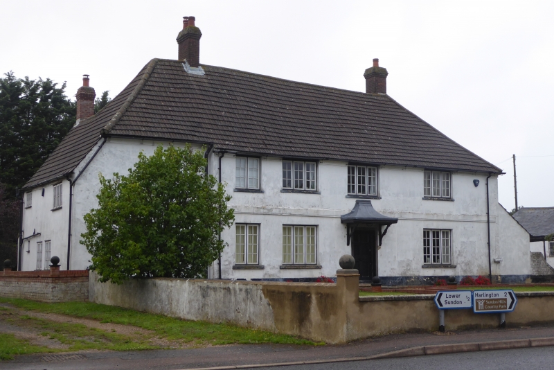
1.
5125 SUNDON HARLINGTON ROAD
Upper Sundon
Hill Farmhouse
TL 02 NW 22/302
II
2.
C18. Whitewashed render. Two storeys, Modern concrete tile hipped roof. Later
2 storey extension to left hand side. Four casement windows. First floor band.
Canopy doorhood.
Listing NGR: TL0471927977
External links are from the relevant listing authority and, where applicable, Wikidata. Wikidata IDs may be related buildings as well as this specific building. If you want to add or update a link, you will need to do so by editing the Wikidata entry.


Other nearby listed buildings
