Latitude: 51.8291 / 51°49'44"N
Longitude: -0.9084 / 0°54'30"W
OS Eastings: 475322
OS Northings: 215062
OS Grid: SP753150
Mapcode National: GBR C18.C4W
Mapcode Global: VHDV3.69M4
Plus Code: 9C3XR3HR+JJ
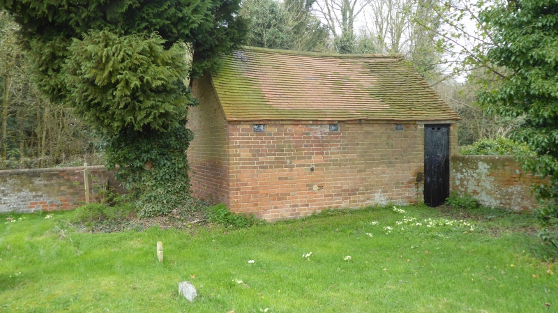
Entry Name: Stable and Attached Boundary Wall Surrounding Graveyard to Baptist Chapel
Listing Date: 29 January 1985
Grade: II
Source: Historic England
Source ID: 1159282
English Heritage Legacy ID: 42274
ID on this website: 101159282
Location: Buckinghamshire, HP18
County: Buckinghamshire
Civil Parish: Waddesdon
Traditional County: Buckinghamshire
Lieutenancy Area (Ceremonial County): Buckinghamshire
Church of England Parish: Waddesdon with Over Winchendon and Fleet Marston
Church of England Diocese: Oxford
Tagged with: Stable
SP 71 NW WADDESDON WADDESDON HILL
5/127A Stable and attached boundary wall surrounding graveyard to Baptist Chapel - GV II
Stable and boundary wall. Early C19. Small brick building in corner of graveyard. Old tile roof, one storey. Double doors to road front, 3 ventilators and small door on graveyard side leading to small room containing a copper. Boundary wall attached, about 1 metre high, with half round brick coping, curving up at two points, with shallow brick buttresses at intervals. Gateway in front of entrance to chapel has square brick piers with stone cappings and simple iron gate. Mounting block to LH, large slabs of limestone attached to boundary wall. Included for group value.
Listing NGR: SP7532215062
External links are from the relevant listing authority and, where applicable, Wikidata. Wikidata IDs may be related buildings as well as this specific building. If you want to add or update a link, you will need to do so by editing the Wikidata entry.


Other nearby listed buildings