Latitude: 51.5828 / 51°34'57"N
Longitude: -0.7402 / 0°44'24"W
OS Eastings: 487386
OS Northings: 187851
OS Grid: SU873878
Mapcode National: GBR D5Q.RPL
Mapcode Global: VHDWC.4H10
Plus Code: 9C3XH7M5+4W
Entry Name: Walls Between Grounds of Manor House and Churchyard
Listing Date: 8 January 1987
Grade: II
Source: Historic England
Source ID: 1159333
English Heritage Legacy ID: 46954
ID on this website: 101159333
Location: St John the Baptist's Church, Little Marlow, Buckinghamshire, SL7
County: Buckinghamshire
Civil Parish: Little Marlow
Traditional County: Buckinghamshire
Lieutenancy Area (Ceremonial County): Buckinghamshire
Church of England Parish: Great Marlow with Marlow Bottom, Little Marlow and Bisham
Church of England Diocese: Oxford
Tagged with: Wall
SU 88 NE
5/70
LITTLE MARLOW
CHURCH ROAD
Walls between grounds of Manor House and churchyard
GV
II
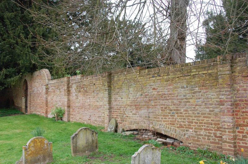
Walls. Probably C18. Brick. Wall along N. side of churchyard has some
chequer brickwork to Manor House grounds, and large diapers of blue headers
to churchyard. Battered coping with cogged string. Raised on series
of shallow segmental arches. N. wall has small gateway with jambs of re-used
moulded stone.
Listing NGR: SU8738687851
External links are from the relevant listing authority and, where applicable, Wikidata. Wikidata IDs may be related buildings as well as this specific building. If you want to add or update a link, you will need to do so by editing the Wikidata entry.


Other nearby listed buildings