Approximate Location Map
Large Map »
Latitude: 51.9492 / 51°56'57"N
Longitude: -0.5321 / 0°31'55"W
OS Eastings: 500984
OS Northings: 228878
OS Grid: TL009288
Mapcode National: GBR G46.Q9R
Mapcode Global: VHFR5.Q8KK
Plus Code: 9C3XWFX9+M5
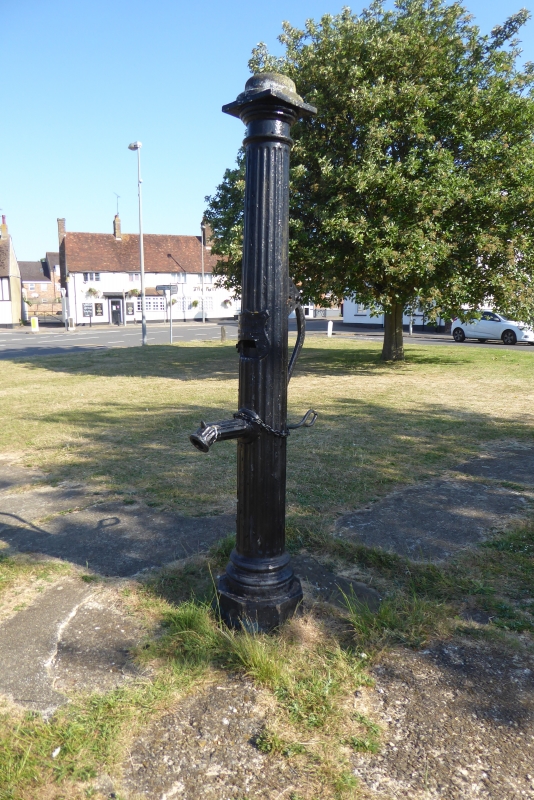
Entry Name: Village Pump
Listing Date: 26 September 1980
Grade: II
Source: Historic England
Source ID: 1159596
English Heritage Legacy ID: 36122
ID on this website: 101159596
Location: Toddington, Central Bedfordshire, LU5
County: Central Bedfordshire
Civil Parish: Toddington
Built-Up Area: Toddington
Traditional County: Bedfordshire
Lieutenancy Area (Ceremonial County): Bedfordshire
Church of England Parish: Toddington
Church of England Diocese: St.Albans
Tagged with: Well
1.
5125 TODDINGTON MARKET SQUARE
Village Pump
TL 0023 20/333
II
2.
C19 cast iron village pump.
Listing NGR: TL0098428878
External links are from the relevant listing authority and, where applicable, Wikidata. Wikidata IDs may be related buildings as well as this specific building. If you want to add or update a link, you will need to do so by editing the Wikidata entry.


Other nearby listed buildings
