Approximate Location Map
Large Map »
Latitude: 50.1164 / 50°6'59"N
Longitude: -5.4788 / 5°28'43"W
OS Eastings: 151404
OS Northings: 29830
OS Grid: SW514298
Mapcode National: GBR DXVC.P7F
Mapcode Global: VH12Z.ZBGM
Plus Code: 9C2P4G8C+HF
Entry Name: Cross Shaft West of St Michael's Mount
Listing Date: 9 October 1987
Grade: II
Source: Historic England
Source ID: 1160210
English Heritage Legacy ID: 69969
ID on this website: 101160210
Location: Marazion, Cornwall, TR17
County: Cornwall
Civil Parish: St. Michael's Mount
Traditional County: Cornwall
Lieutenancy Area (Ceremonial County): Cornwall
Tagged with: Monumental cross
MARAZION ST MICHAEL'S MOUNT
SW 53 sir
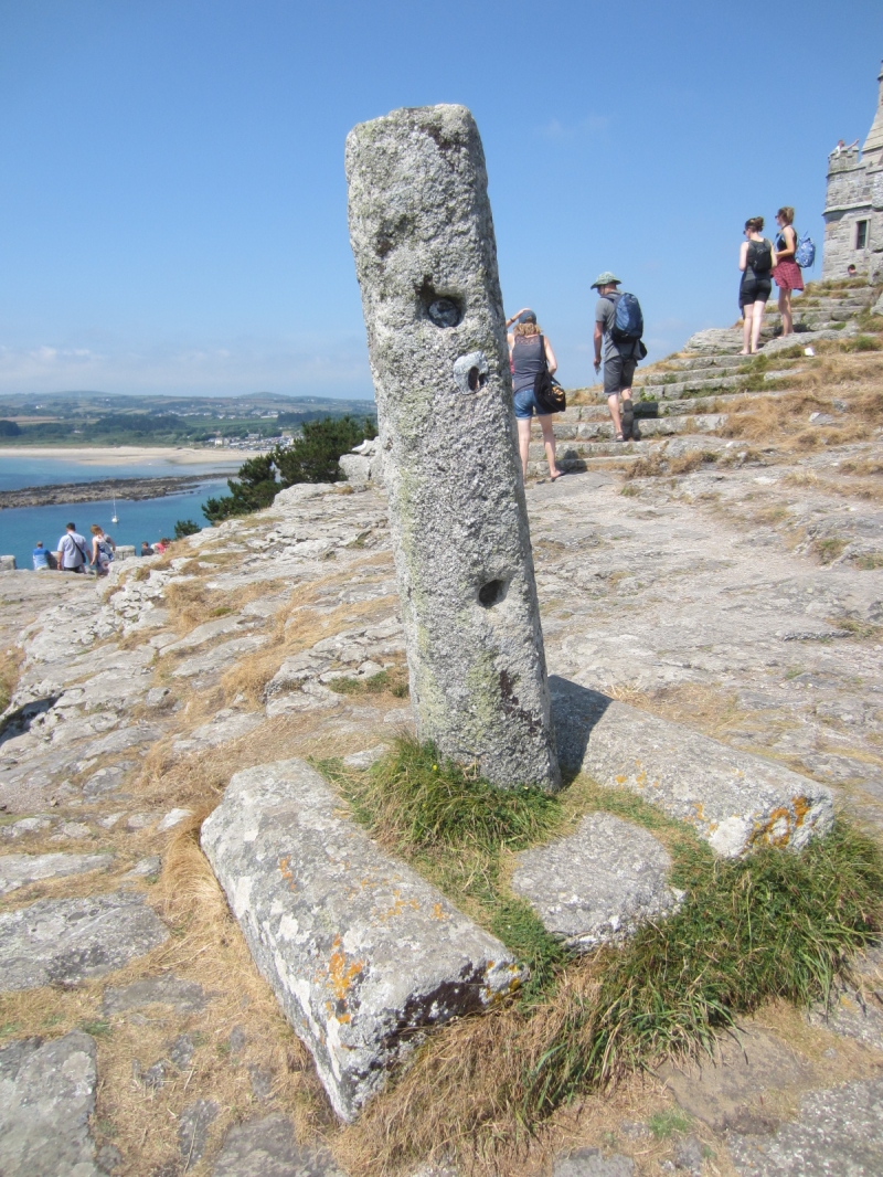
1/59 (was part of 9/157) Cross shaft west of St Michael's
Mount
GV II
Cross shaft. Medieval. Tall granite monolith. Octagonal-on-plan shaft, splayed
wider at base, set over rocky outcrop within earth and stone platform bordered on 2
sides by reused medieval chamfered granite monoliths.
Listing NGR: SW5140429830
External links are from the relevant listing authority and, where applicable, Wikidata. Wikidata IDs may be related buildings as well as this specific building. If you want to add or update a link, you will need to do so by editing the Wikidata entry.


Other nearby listed buildings
