Latitude: 54.58 / 54°34'47"N
Longitude: -1.8053 / 1°48'19"W
OS Eastings: 412681
OS Northings: 520547
OS Grid: NZ126205
Mapcode National: GBR HHTG.YZ
Mapcode Global: WHC5L.74LR
Plus Code: 9C6WH5HV+XV
Entry Name: Hazledene and Neville House
Listing Date: 14 September 1966
Grade: II
Source: Historic England
Source ID: 1160836
English Heritage Legacy ID: 111551
ID on this website: 101160836
Location: Staindrop, County Durham, DL2
County: County Durham
Civil Parish: Staindrop
Built-Up Area: Staindrop
Traditional County: Durham
Lieutenancy Area (Ceremonial County): County Durham
Church of England Parish: Staindrop
Church of England Diocese: Durham
Tagged with: Architectural structure
STAINDROP SOUTH GREEN NZ 1220 (South side) 17/186 Nos. 20 and 21 14/9/66 (Hazledene and Neville House)
GV II
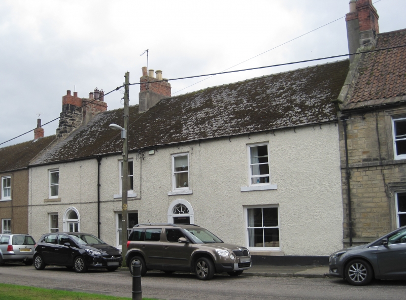
2 houses. C18 with C19 alterations. Pebble-dash render with painted ashlar dressings; roof of dark grey asbestos slates with rendered and brick chimneys. 2 storeys, 4 bays, the first and fourth wider. Half-glazed C20 door at right of first bay with fanlight in panelled round-headed surround resited from chapel in North Green at time of demolition; half-glazed 4-panel door and patterned fanlight in plain round-headed surround in third bay. Narrow plain sashes to first bay with projecting stone sills; similar sills to 2 large ground floor sashes to No. 21 at right, and 3 plain first-floor sashes. 3 ridge chimneys at ends and between houses.
Included for group value.
Listing NGR: NZ1268220544
External links are from the relevant listing authority and, where applicable, Wikidata. Wikidata IDs may be related buildings as well as this specific building. If you want to add or update a link, you will need to do so by editing the Wikidata entry.


Other nearby listed buildings