Approximate Location Map
Large Map »
Latitude: 53.9198 / 53°55'11"N
Longitude: -0.524 / 0°31'26"W
OS Eastings: 497036
OS Northings: 448079
OS Grid: SE970480
Mapcode National: GBR SRS3.CM
Mapcode Global: WHGDP.XQNX
Plus Code: 9C5XWF9G+WC
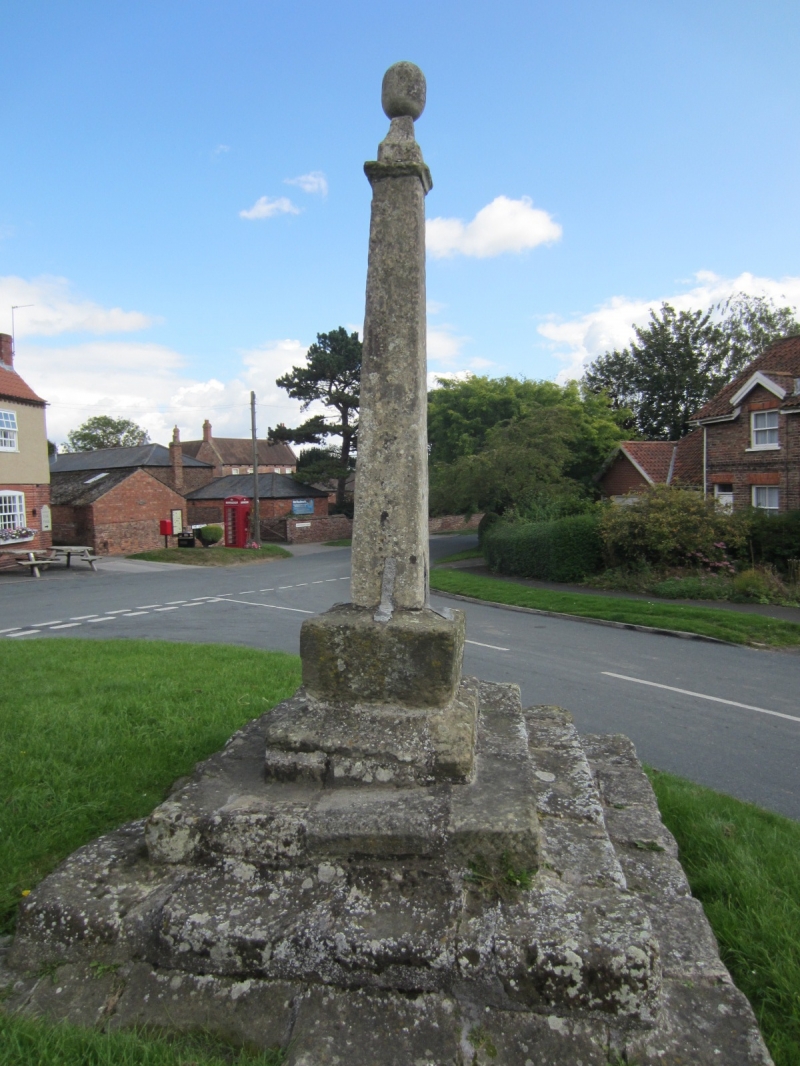
Entry Name: Market Cross
Listing Date: 7 February 1968
Grade: II
Source: Historic England
Source ID: 1161400
English Heritage Legacy ID: 164588
ID on this website: 101161400
Location: Lund, East Riding of Yorkshire, YO25
County: East Riding of Yorkshire
Civil Parish: Lund
Built-Up Area: Lund
Traditional County: Yorkshire
Lieutenancy Area (Ceremonial County): East Riding of Yorkshire
Church of England Parish: Lund All Saints
Church of England Diocese: York
Tagged with: Market cross
LUND THE GREEN
SE 94 NE
2/53 Market Cross
7.2.68
II
Cross. Late medieval, probably rebuilt in C18. Limestone. Triple stepped
plinth to cubical base holding 4-sided tapering shaft with damaged finial.
Scheduled as an Ancient Monument,
Listing NGR: SE9703648079
External links are from the relevant listing authority and, where applicable, Wikidata. Wikidata IDs may be related buildings as well as this specific building. If you want to add or update a link, you will need to do so by editing the Wikidata entry.


Other nearby listed buildings
