Approximate Location Map
Large Map »
Latitude: 52.3227 / 52°19'21"N
Longitude: -0.0754 / 0°4'31"W
OS Eastings: 531266
OS Northings: 271145
OS Grid: TL312711
Mapcode National: GBR K4B.CRY
Mapcode Global: VHGLY.NW08
Plus Code: 9C4X8WFF+3R
Entry Name: The Bridge
Listing Date: 29 September 1951
Grade: I
Source: Historic England
Source ID: 1161421
English Heritage Legacy ID: 53331
ID on this website: 101161421
Location: St Ives, Huntingdonshire, Cambridgeshire, PE27
County: Cambridgeshire
District: Huntingdonshire
Civil Parish: Saint Ives
Built-Up Area: St Ives
Traditional County: Huntingdonshire
Lieutenancy Area (Ceremonial County): Cambridgeshire
Church of England Parish: Hemingford Grey St James
Church of England Diocese: Ely
Tagged with: Deck arch bridge
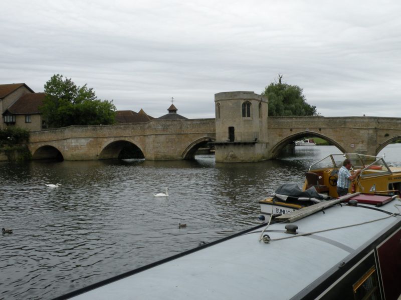
1.
1588
TL 3171 1/2 29.9.51 The Bridge
I
2.
Circa 1415-26 replacing a wooden bridge of 1110. Barnach ashlar with
brick parapet of circa 1716. 6 arches on piers with pointed cutwaters
carried up to the parapets to form refuges. 4 original northern
arches are pointed but the 2 semi-circular southern ones were rebuilt
in 1716, replacing a Civil War drawbridge over the southernmost span.
Scheduled A.M.
Listing NGR: TL3126671145
External links are from the relevant listing authority and, where applicable, Wikidata. Wikidata IDs may be related buildings as well as this specific building. If you want to add or update a link, you will need to do so by editing the Wikidata entry.


Other nearby listed buildings
