Approximate Location Map
Large Map »
Latitude: 53.8427 / 53°50'33"N
Longitude: -0.4333 / 0°25'59"W
OS Eastings: 503180
OS Northings: 439637
OS Grid: TA031396
Mapcode National: GBR TSD0.Z7
Mapcode Global: WHGF4.9NXY
Plus Code: 9C5XRHV8+3M
Entry Name: 16, Lairgate
Listing Date: 2 July 1969
Grade: II
Source: Historic England
Source ID: 1161762
English Heritage Legacy ID: 167251
ID on this website: 101161762
Location: Beverley, East Riding of Yorkshire, HU17
County: East Riding of Yorkshire
Civil Parish: Beverley
Built-Up Area: Beverley
Traditional County: Yorkshire
Lieutenancy Area (Ceremonial County): East Riding of Yorkshire
Church of England Parish: Beverley St Mary
Church of England Diocese: York
Tagged with: Building
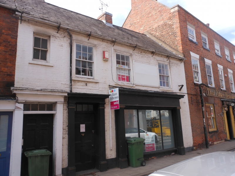
TA 0339 BEVERLEY LAIRGATE
(west side)
9/150 No 16
2.7.69
GV II
Probably C18. Two storeys in painted brick with slate roof. Three windows,
gauged flat arches, near flush frame sashes without glazing bars. Entrance
with 6-panel door and 4-pane fanlight in case with pilasters and entablature.
Listing NGR: TA0318039637
External links are from the relevant listing authority and, where applicable, Wikidata. Wikidata IDs may be related buildings as well as this specific building. If you want to add or update a link, you will need to do so by editing the Wikidata entry.


Other nearby listed buildings
