Latitude: 53.4602 / 53°27'36"N
Longitude: -2.0891 / 2°5'20"W
OS Eastings: 394182
OS Northings: 395945
OS Grid: SJ941959
Mapcode National: GBR FXVF.JB
Mapcode Global: WHB9Q.W9C5
Plus Code: 9C5VFW66+39
Entry Name: Cruckframe Building Formerly Part of Newton Hall
Listing Date: 22 December 1969
Grade: II
Source: Historic England
Source ID: 1162410
English Heritage Legacy ID: 212476
ID on this website: 101162410
Location: Flowery Field, Tameside, Greater Manchester, SK14
County: Tameside
Electoral Ward/Division: Hyde Newton
Parish: Non Civil Parish
Built-Up Area: Hyde (Tameside)
Traditional County: Cheshire
Lieutenancy Area (Ceremonial County): Greater Manchester
Church of England Parish: Newton with Flowery Field St Mary
Church of England Diocese: Chester
Tagged with: Architectural structure Thatched building
HYDE DUKINFIELD ROAD SJ 99 NW (west side) 3/20 Cruckframe building formerly part of 22.12.69 Newton Hall - II
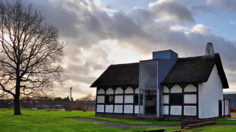
Part of house. Probably C16, restored 1970. Cruck-framed with timber-framed side walls, rendered rear and thatch roof. Only the hall remains which is open to the roof. Heavily restored square-panel framing on a stone plinth, each of the 10 studs having diagonal bracing. 3 windows with timber diamond mullions and a projecting portion of patent glazing behind which the panels have been removed to expose the frame. The left gable reveals a cruck frame. Rendered stack to right gable. 3 pairs of crucks (including one in gable). The two central frames have double cruck spurs, curved wind bracing, a collar tie which has been removed in one case and renewed in the other and are butt- joined to the ridge purlin. Smoke hood at right.
Listing NGR: SJ9418295945
External links are from the relevant listing authority and, where applicable, Wikidata. Wikidata IDs may be related buildings as well as this specific building. If you want to add or update a link, you will need to do so by editing the Wikidata entry.


Other nearby listed buildings