Latitude: 53.9403 / 53°56'25"N
Longitude: -2.3283 / 2°19'42"W
OS Eastings: 378543
OS Northings: 449404
OS Grid: SD785494
Mapcode National: GBR DQ5W.Q8
Mapcode Global: WH965.67J4
Plus Code: 9C5VWMRC+4M
Entry Name: Village Cross
Listing Date: 16 November 1954
Last Amended: 20 February 1984
Grade: II
Source: Historic England
Source ID: 1163351
English Heritage Legacy ID: 183237
ID on this website: 101163351
Location: Bolton-by-Bowland, Ribble Valley, Lancashire, BB7
County: Lancashire
District: Ribble Valley
Civil Parish: Bolton-by-Bowland
Traditional County: Yorkshire
Lieutenancy Area (Ceremonial County): Lancashire
Church of England Parish: Bolton by Bowland St Peter and St Paul
Church of England Diocese: Blackburn
Tagged with: High cross
BOLTON-BY-BOWLAND SD 78 49
13/65 Village Cross (formerly listed as Remains of Village Cross) 16.ll.1954 GV II
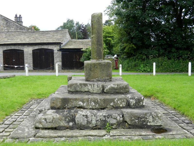
Cross shaft and base, possibly medieval. Sandstone. Shaft rectangular on plan, with upper part missing. Socketed into a block of square plan which stands on a base of 4 steps.
Listing NGR: SD7854349404
External links are from the relevant listing authority and, where applicable, Wikidata. Wikidata IDs may be related buildings as well as this specific building. If you want to add or update a link, you will need to do so by editing the Wikidata entry.


Other nearby listed buildings