Approximate Location Map
Large Map »
Latitude: 53.5932 / 53°35'35"N
Longitude: -2.2978 / 2°17'51"W
OS Eastings: 380388
OS Northings: 410774
OS Grid: SD803107
Mapcode National: GBR DVDW.BP
Mapcode Global: WH97Q.PY18
Plus Code: 9C5VHPV2+7V
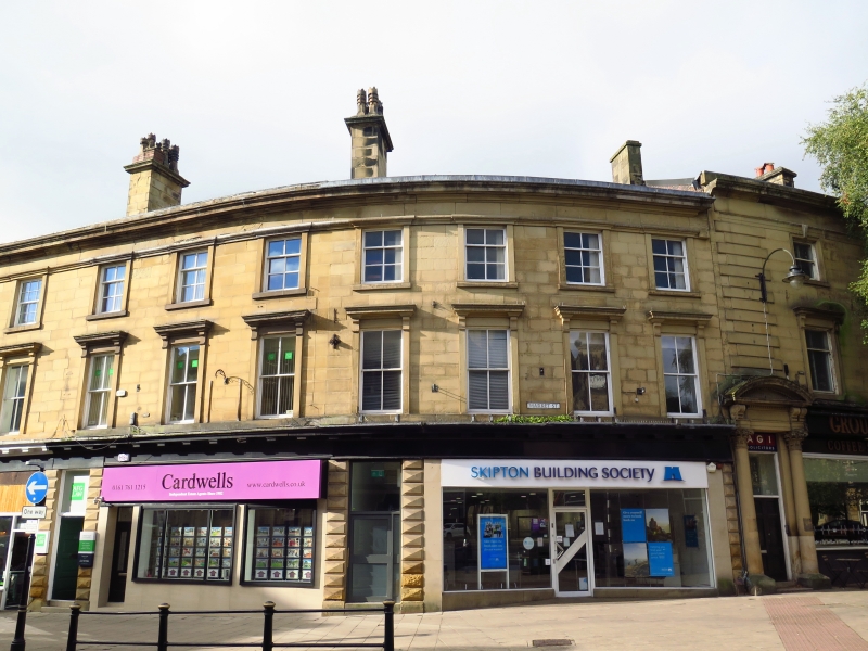
Entry Name: 12-16, Market Street
Listing Date: 29 January 1985
Grade: II
Source: Historic England
Source ID: 1163613
English Heritage Legacy ID: 210686
ID on this website: 101163613
Location: Bury, Greater Manchester, BL9
County: Bury
Electoral Ward/Division: East
Parish: Non Civil Parish
Built-Up Area: Bury
Traditional County: Lancashire
Lieutenancy Area (Ceremonial County): Greater Manchester
Church of England Parish: Bury St Mary the Virgin
Church of England Diocese: Manchester
Tagged with: Building
SD 8010 NW MARKET STREET
1/51
- Nos 12 to 16 (even)
GV II
Between 1850 and 1860. Curved front. Classical. Ashlar. 2 storeys, but lower
than Nos 2 to 10. 9 sash windows, those on first floor with bracketed cornices.
Shop fronts on ground floor and doors with faceted rustication. Cornice and blocking
course overall.
Listing NGR: SD8038810774
External links are from the relevant listing authority and, where applicable, Wikidata. Wikidata IDs may be related buildings as well as this specific building. If you want to add or update a link, you will need to do so by editing the Wikidata entry.


Other nearby listed buildings
