Latitude: 52.6562 / 52°39'22"N
Longitude: -0.4319 / 0°25'54"W
OS Eastings: 506167
OS Northings: 307648
OS Grid: TF061076
Mapcode National: GBR FVT.KM1
Mapcode Global: WHGLY.BHLK
Plus Code: 9C4XMH49+F6
Entry Name: Gates, Piers and Wall to Demolished Uffington House
Listing Date: 30 October 1968
Grade: II*
Source: Historic England
Source ID: 1165717
English Heritage Legacy ID: 194635
ID on this website: 101165717
Location: Uffington, South Kesteven, Lincolnshire, PE9
County: Lincolnshire
District: South Kesteven
Civil Parish: Uffington
Built-Up Area: Uffington
Traditional County: Lincolnshire
Lieutenancy Area (Ceremonial County): Lincolnshire
Church of England Parish: Uffington St Michael
Church of England Diocese: Lincoln
Tagged with: Gate
TF 00 NE
9/250
30.10.68
UFFINGTON
MAIN STREET
Gates, piers and wall to demolished Uffington House
G.V.
II*
Gates, piers and flanking walls. c.1700 piers possibly by John
Lumley. Gates are C19. Ashlar, red brick, terracotta and
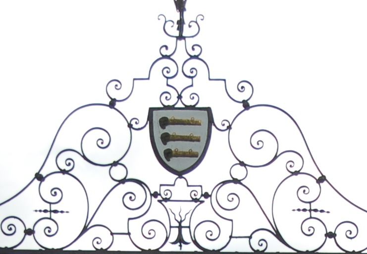
wrought iron. Pair of wrought iron gates having curlicued rails
and panels with scrolled overthrow containing Bertie Arms
surmounted by wildman badge. Flanked by rusticated fluted panels
to the front, surmounted by C19 Blashfield terracotta urns. To
either side are scrolled supports to the tall walls, which have a
high plinth and plain circular copings and are in Flemish bond,
red brick with dark burnt headers.
Listing NGR: TF0616707648
External links are from the relevant listing authority and, where applicable, Wikidata. Wikidata IDs may be related buildings as well as this specific building. If you want to add or update a link, you will need to do so by editing the Wikidata entry.


Other nearby listed buildings