Latitude: 52.244 / 52°14'38"N
Longitude: -2.7032 / 2°42'11"W
OS Eastings: 352085
OS Northings: 260880
OS Grid: SO520608
Mapcode National: GBR FL.0Q49
Mapcode Global: VH84Q.3V9M
Plus Code: 9C4V67VW+JP
Entry Name: Lower Stockton
Listing Date: 11 June 1959
Last Amended: 23 September 1987
Grade: II
Source: Historic England
Source ID: 1166914
English Heritage Legacy ID: 150515
ID on this website: 101166914
Location: Stockton, County of Herefordshire, HR6
County: County of Herefordshire
Civil Parish: Kimbolton
Traditional County: Herefordshire
Lieutenancy Area (Ceremonial County): Herefordshire
Church of England Parish: Kimbolton with Hammish
Church of England Diocese: Hereford
Tagged with: Architectural structure
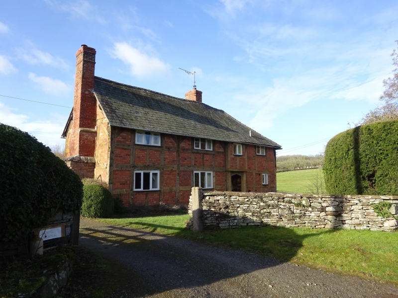
KIMBOLTON CP STOCKTON SO 56 SW 7/25 Lower Stockton (formerly listed as 11.6.59 Cottage, immediately south of ford and 30 yards north-west of Stockton Terrace) GV II House. C17, C20 alterations. Timber-framed with brick infill, sandstone rubble plinth and stacks with brick shafts, part-hipped Welsh slate roof. Three framed bays aligned north-west/south-east facing north-east, axial and gable end stacks, entrance to north-east front. Two storeys; two 3- light C20 casements to left and one 2-light casement to right of similar casement in slightly projecting section over entrance, ground floor has similar 3-light windows to left and a 2-light window to right of C20 Tudor arched entrance with inner C20 ledged door. Interior inaccessible.
Listing NGR: SO5208560880
External links are from the relevant listing authority and, where applicable, Wikidata. Wikidata IDs may be related buildings as well as this specific building. If you want to add or update a link, you will need to do so by editing the Wikidata entry.


Other nearby listed buildings