Latitude: 53.9369 / 53°56'12"N
Longitude: -1.0731 / 1°4'23"W
OS Eastings: 460950
OS Northings: 449372
OS Grid: SE609493
Mapcode National: GBR NQYX.HH
Mapcode Global: WHFC9.H97R
Plus Code: 9C5WWWPG+QQ
Entry Name: The White House, White House North and White House South
Listing Date: 17 November 1966
Last Amended: 14 March 1986
Grade: II
Source: Historic England
Source ID: 1167038
English Heritage Legacy ID: 326164
ID on this website: 101167038
Location: York, North Yorkshire, YO10
County: York
Civil Parish: Fulford
Built-Up Area: York
Traditional County: Yorkshire
Lieutenancy Area (Ceremonial County): North Yorkshire
Church of England Parish: Fulford St Oswald
Church of England Diocese: York
Tagged with: Architectural structure
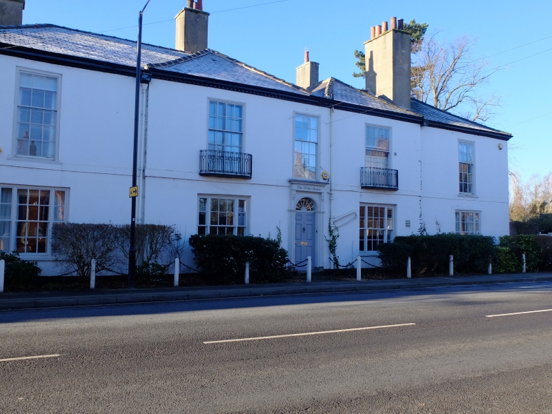
FULFORD YORK ROAD SE 64 NW (west side) 5/52 No 14 (The White House, White House North and White House South 17.11.66 (formerly listed as White House (3 flats) under Main Street) - II House now 3 houses, early C19. Colourwashed cement render with Welsh slate roof. 2 storeys, 5 bays of which the central 3 project slightly. Central entrance a 6-fielded panel door beneath radial fanlight in door case of fluted pilasters and consoles supporting dentil frieze. Ground floor has tripartite sashes with glazing bars. First floor band. First floor: unequally-hung 15 and 20-pane sashes. Wrought-iron balconies to second and fourth bays. Dentil cornice. 2 hipped roofs joining at centre. Front and rear stacks. Interior: open well staircase with turned balusters.
Listing NGR: SE6095049372
External links are from the relevant listing authority and, where applicable, Wikidata. Wikidata IDs may be related buildings as well as this specific building. If you want to add or update a link, you will need to do so by editing the Wikidata entry.


Other nearby listed buildings