Latitude: 52.0376 / 52°2'15"N
Longitude: -2.005 / 2°0'18"W
OS Eastings: 399750
OS Northings: 237693
OS Grid: SO997376
Mapcode National: GBR 2KP.9WJ
Mapcode Global: VHB15.61CS
Plus Code: 9C4V2XQV+3X
Entry Name: Village Cross About 50 Yards East of the Church of St Barbara
Listing Date: 30 July 1959
Grade: II
Source: Historic England
Source ID: 1167161
English Heritage Legacy ID: 148456
ID on this website: 101167161
Location: Ashton under Hill, Wychavon, Worcestershire, WR11
County: Worcestershire
District: Wychavon
Civil Parish: Ashton under Hill
Built-Up Area: Ashton under Hill
Traditional County: Gloucestershire
Lieutenancy Area (Ceremonial County): Worcestershire
Church of England Parish: Overbury with Teddington, Alstone and Little Washbourne with Beckford and Ashton-under-Hill
Church of England Diocese: Worcester
ASHTON UNDER HILL CP BECKFORD ROAD (west side) SO 9837 - 9937 11/4 22/2 Village Cross about SO yards east of the Church of 30-7-59 St Barbara GV II
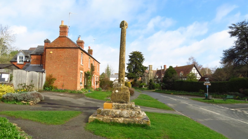
Village cross. C15. Limestone. Square three-stepped plinth on which stands a square base with chamfered upper edges. The cross shaft is octagonal and has a shield relief on the east side; it is complete apart from the very top which has been replaced by a sundial. The cross has survived in a good and almost unaltered condition and is prominently situated at the main southern approach to the village. (BoE, p 72).
Listing NGR: SO9975037693


Other nearby listed buildings