Approximate Location Map
Large Map »
Latitude: 50.7235 / 50°43'24"N
Longitude: -3.5309 / 3°31'51"W
OS Eastings: 292036
OS Northings: 92657
OS Grid: SX920926
Mapcode National: GBR P0.PZY9
Mapcode Global: FRA 37H5.G7R
Plus Code: 9C2RPFF9+9J
Entry Name: 45, High Street
Listing Date: 18 June 1974
Grade: II
Source: Historic England
Source ID: 1170494
English Heritage Legacy ID: 89222
ID on this website: 101170494
Location: Exeter, Devon, EX4
County: Devon
District: Exeter
Electoral Ward/Division: St David's
Parish: Non Civil Parish
Built-Up Area: Exeter
Traditional County: Devon
Lieutenancy Area (Ceremonial County): Devon
Church of England Parish: Central Exeter
Church of England Diocese: Exeter
Tagged with: Building
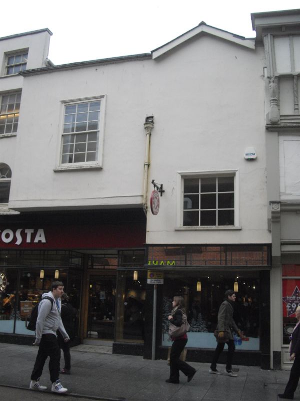
HIGH STREET
1.
1092
(South-east Side)
No 45
SX 9292 NW 3/941
II GV
2.
Probably C16 but very altered on the frontage C18/C19. Timber framed behind, rendered
and painted. 3 storeys, modern shopfront, window above only on the 1st floor.
Slight overhang. Gable to street, roof not visible. Moulded 1st floor beams.
Included for group value.
Nos 39 to 47 (consec) form a group.
Listing NGR: SX9204492657
External links are from the relevant listing authority and, where applicable, Wikidata. Wikidata IDs may be related buildings as well as this specific building. If you want to add or update a link, you will need to do so by editing the Wikidata entry.


Other nearby listed buildings
