Approximate Location Map
Large Map »
Latitude: 50.9921 / 50°59'31"N
Longitude: -2.3161 / 2°18'57"W
OS Eastings: 377914
OS Northings: 121464
OS Grid: ST779214
Mapcode National: GBR 0W6.P8G
Mapcode Global: FRA 661H.7K5
Plus Code: 9C2VXMRM+VH
Entry Name: Three Farthings
Listing Date: 14 June 1984
Grade: II
Source: Historic England
Source ID: 1171247
English Heritage Legacy ID: 102651
ID on this website: 101171247
Location: Fifehead Magdalen, Dorset, SP8
County: Dorset
Civil Parish: Fifehead Magdalen
Traditional County: Dorset
Lieutenancy Area (Ceremonial County): Dorset
Church of England Parish: Fifehead Magdalen St Mary Magdalene
Church of England Diocese: Salisbury
Tagged with: Architectural structure Thatched cottage
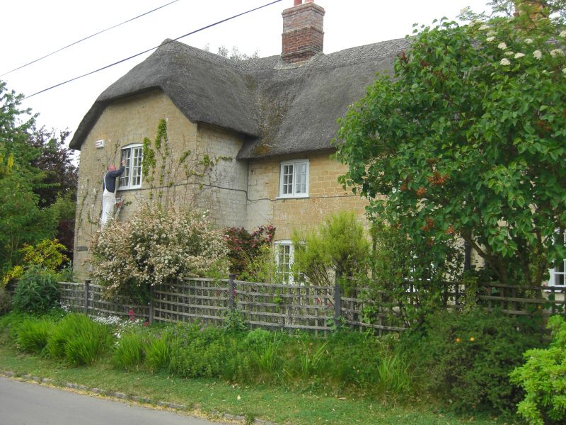
ST 72 SE FIFEHEAD MAGDALEN FIFEHEAD HILL
2/20 No 9,Three Farthings
GV II
House, probably early Cl9. Coursed squared rubble with half-hipped,
thatched roofs, end stacks. 2 storeys. T-plan. C20, 2-light
casements with glazing bars.
Listing NGR: ST7791421464
External links are from the relevant listing authority and, where applicable, Wikidata. Wikidata IDs may be related buildings as well as this specific building. If you want to add or update a link, you will need to do so by editing the Wikidata entry.


Other nearby listed buildings
