Approximate Location Map
Large Map »
Latitude: 50.73 / 50°43'47"N
Longitude: -3.9233 / 3°55'24"W
OS Eastings: 264354
OS Northings: 94028
OS Grid: SX643940
Mapcode National: GBR Q6.2CYF
Mapcode Global: FRA 27N4.Z73
Plus Code: 9C2RP3HG+XM
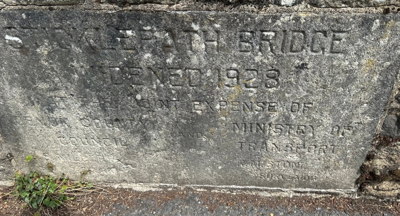
Entry Name: Sticklepath Bridge
Listing Date: 4 March 1988
Grade: II
Source: Historic England
Source ID: 1171622
English Heritage Legacy ID: 95051
ID on this website: 101171622
Location: Sticklepath, West Devon, EX20
County: Devon
District: West Devon
Civil Parish: Sticklepath
Traditional County: Devon
Lieutenancy Area (Ceremonial County): Devon
Church of England Parish: Belstone St Mary
Church of England Diocese: Exeter
Tagged with: Bridge
SX 69 SW SOUTH TAWTON STICKLEPATH
3/249 Sticklepath Bridge
II
Road bridge over the River Taw. Probably C18. Snecked blocks of rusticated granite
ashlar. 2-span bridge, each a segmental arch rising from vertical abutments.
Between the two a pointed cutwater rises into the parapet to provide small refuges
each side of the road. The parapet has plain granite coping. No terminal piers.
Listing NGR: SX6435494028
External links are from the relevant listing authority and, where applicable, Wikidata. Wikidata IDs may be related buildings as well as this specific building. If you want to add or update a link, you will need to do so by editing the Wikidata entry.


Other nearby listed buildings
