Approximate Location Map
Large Map »
Latitude: 50.748 / 50°44'52"N
Longitude: -3.827 / 3°49'37"W
OS Eastings: 271201
OS Northings: 95863
OS Grid: SX712958
Mapcode National: GBR QD.06LR
Mapcode Global: FRA 27W3.DVT
Plus Code: 9C2RP5XF+65
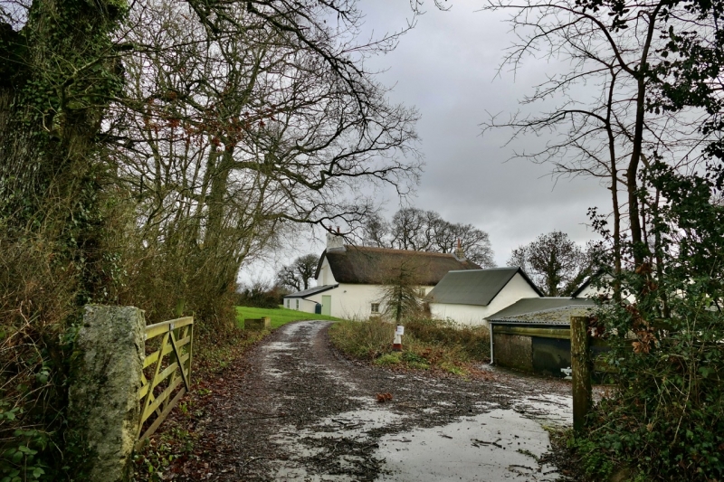
Entry Name: Croft Farmhouse
Listing Date: 4 March 1988
Grade: II
Source: Historic England
Source ID: 1171664
English Heritage Legacy ID: 95057
ID on this website: 101171664
Location: West Devon, EX17
County: Devon
District: West Devon
Civil Parish: Spreyton
Traditional County: Devon
Lieutenancy Area (Ceremonial County): Devon
Church of England Parish: Spreyton St Michael
Church of England Diocese: Exeter
Tagged with: Farmhouse
SX 79 NW SPREYTON
2/256 Croft Farmhouse
II
Farmhouse. Of or earlier. Plastered cob on stone rubble footings; stone rubble
or cob stacks, one with its original granite ashlar chimneyshaft; corrugated
asbestos roof, formerly thatch.
Plan: evidently this was originally a 3-room-and-through-passage plan farmhouse
facing south-south-east, say south, but the service end room has been demolished.
The inner room at the right (west) end has a gable-end stack and the hall has an
axial stack backing onto the passage which is now at the left end of the house.
Since no internal inspection was available at the time of this survey the early
development of the house cannot be outlined here. Nevertheless it seems likely that
it began as some form of open hall house, maybe heated by an open hearth fire. By
the late C17 the fireplaces would have been inserted and the rooms floored over.
Now the passage is disused as an entrance. A new front doorway has been provided
into the inner room. House is 2 storeys.
Exterior: irregular 4-window front of C19 and C20 casements with glazing bars. The
passage front doorway at the right end and the present front doorway left of centre
both contain C20 plank door. Roof is gable-ended to left and half-hipped to right.
Interior: was not available for inspection at the time of this survey but the
farmer claims that it contains a great deal of early carpentry detail and that it
has been little modernised since the C19. A detailed internal investigation should
be undertaken before any modernisation or alteration here.
Listing NGR: SX7120195863
External links are from the relevant listing authority and, where applicable, Wikidata. Wikidata IDs may be related buildings as well as this specific building. If you want to add or update a link, you will need to do so by editing the Wikidata entry.


Other nearby listed buildings
