Latitude: 51.7478 / 51°44'51"N
Longitude: -2.2834 / 2°17'0"W
OS Eastings: 380530
OS Northings: 205490
OS Grid: SO805054
Mapcode National: GBR 0L4.CJD
Mapcode Global: VH94X.CBQH
Plus Code: 9C3VPPX8+4J
Entry Name: Milestone
Listing Date: 3 July 1977
Grade: II
Source: Historic England
Source ID: 1171951
English Heritage Legacy ID: 132053
ID on this website: 101171951
Location: Stonehouse, Stroud, Gloucestershire, GL10
County: Gloucestershire
District: Stroud
Civil Parish: Stonehouse
Built-Up Area: Stonehouse
Traditional County: Gloucestershire
Lieutenancy Area (Ceremonial County): Gloucestershire
Church of England Parish: Stonehouse St Cyr
Church of England Diocese: Gloucester
Tagged with: Milestone
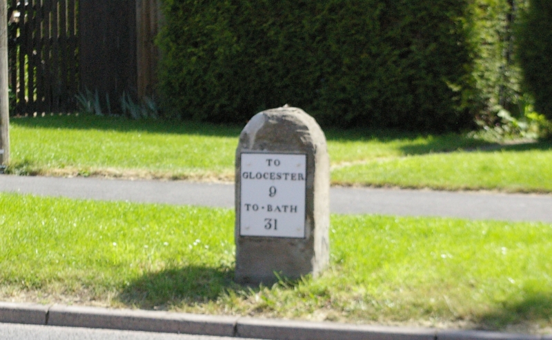
SO 8005 SE at STONEHOUSE HIGH STREET
NGR SO 80530549 (east side)
7/177 Milestone
3.7.77
II
Milestone. Late C18. Iron plate with raised serif lettering and
border, mounted on rectangular sandstone post with rounded top.
Plate reads: 'TO / GLOCESTER / 9 / TO BATH / 31'.
Listing NGR: SO8053005490
External links are from the relevant listing authority and, where applicable, Wikidata. Wikidata IDs may be related buildings as well as this specific building. If you want to add or update a link, you will need to do so by editing the Wikidata entry.


Other nearby listed buildings