Approximate Location Map
Large Map »
Latitude: 51.7534 / 51°45'12"N
Longitude: -0.3421 / 0°20'31"W
OS Eastings: 514534
OS Northings: 207384
OS Grid: TL145073
Mapcode National: GBR H89.4B0
Mapcode Global: VHGPQ.06Z4
Plus Code: 9C3XQM35+95
Entry Name: 1-7, College Street
Listing Date: 27 August 1971
Grade: II
Source: Historic England
Source ID: 1172757
English Heritage Legacy ID: 163224
ID on this website: 101172757
Location: St Albans, St. Albans, Hertfordshire, AL3
County: Hertfordshire
District: St. Albans
Electoral Ward/Division: Verulam
Parish: Non Civil Parish
Built-Up Area: St Albans
Traditional County: Hertfordshire
Lieutenancy Area (Ceremonial County): Hertfordshire
Church of England Parish: Abbey Parish of St Albans
Church of England Diocese: St.Albans
Tagged with: Building
1.
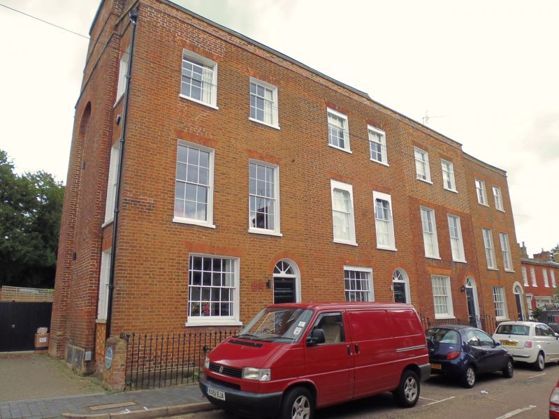
1582 COLLEGE STREET
(North Side)
Nos 1 to 7 (odd)
TL 1407 SE 9/l74
II GV
2.
Early C19 terrace. Each house 3 storeys and sunk basement, 2 windows.
Red brick with brick parapet. Nos 1 and 3 have slate mansard roofs with
skylights. Roofs of Nos 5 and 7 concealed behind parapet. Gauged, flat,
brick arches to sash windows with glazing bars, those on ground floor
wider and having margin lights also. Round arched door with cornice head
and radial fanlight. All doors and windows recessed in stucco-lined
reveals. Wide-panelled door. Cast iron area railings with spearhead
standards and ball finials.
[Nos 1 to 27A (odd) form a group.
Listing NGR: TL1453407384
External links are from the relevant listing authority and, where applicable, Wikidata. Wikidata IDs may be related buildings as well as this specific building. If you want to add or update a link, you will need to do so by editing the Wikidata entry.


Other nearby listed buildings
