Latitude: 51.1833 / 51°10'59"N
Longitude: -3.4447 / 3°26'41"W
OS Eastings: 299119
OS Northings: 143663
OS Grid: SS991436
Mapcode National: GBR LK.5R56
Mapcode Global: VH6GM.7JR8
Plus Code: 9C3R5HM4+84
Entry Name: 14 and 16, Church Street
Listing Date: 6 November 1975
Grade: II
Source: Historic England
Source ID: 1173290
English Heritage Legacy ID: 264657
ID on this website: 101173290
Location: Dunster, Somerset, TA24
County: Somerset
District: Somerset West and Taunton
Civil Parish: Dunster
Built-Up Area: Dunster
Traditional County: Somerset
Lieutenancy Area (Ceremonial County): Somerset
Tagged with: Building
1. 5366 DUNSTER CHURCH STREET
Nos 14 and 16 SS 9843-9943 4/25 6.11.75
II GV
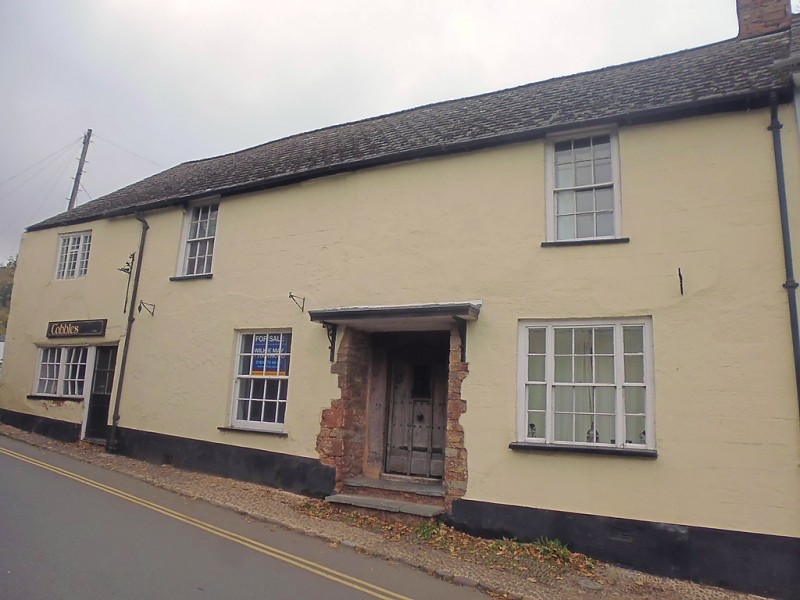
2. 18th century front to possibly earlier building. Rendered, slate roof. Two storeys. Three windows, two sashes with glazing bars, 3-light casement. Pair of small-paned fixed-light shop windows to ground floor left-hand. Square-headed door opening with ribbed door in flat-arched frame.
Listing NGR: SS9911943663
External links are from the relevant listing authority and, where applicable, Wikidata. Wikidata IDs may be related buildings as well as this specific building. If you want to add or update a link, you will need to do so by editing the Wikidata entry.


Other nearby listed buildings