Latitude: 54.1946 / 54°11'40"N
Longitude: -0.9346 / 0°56'4"W
OS Eastings: 469610
OS Northings: 478176
OS Grid: SE696781
Mapcode National: GBR PMXY.G3
Mapcode Global: WHFB0.MT5P
Plus Code: 9C6X53V8+V5
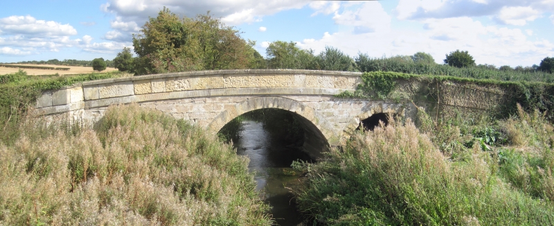
Entry Name: East Ness Bridge
Listing Date: 22 June 1987
Grade: II
Source: Historic England
Source ID: 1173364
English Heritage Legacy ID: 329134
ID on this website: 101173364
Location: East Ness, North Yorkshire, YO62
County: North Yorkshire
District: Ryedale
Civil Parish: Nunnington
Traditional County: Yorkshire
Lieutenancy Area (Ceremonial County): North Yorkshire
Church of England Parish: Slingsby All Saints
Church of England Diocese: York
SE 67 NE
2/177
SOUTH HOLME
SOUTH HOLME TO NESS ROAD
East Ness Bridge
II
Bridge. C18. Limestone ashlar. 3 stepped segmental arches with milled
stone voussoirs. Band and coped parapet.
Listing NGR: SE6961078176


Other nearby listed buildings