Approximate Location Map
Large Map »
Latitude: 53.7411 / 53°44'28"N
Longitude: -1.1325 / 1°7'56"W
OS Eastings: 457315
OS Northings: 427543
OS Grid: SE573275
Mapcode National: GBR NTJ5.MN
Mapcode Global: WHDC3.K7YB
Plus Code: 9C5WPVR9+F2
Entry Name: Paper House Bridge
Listing Date: 17 November 1986
Grade: II
Source: Historic England
Source ID: 1174087
English Heritage Legacy ID: 326464
ID on this website: 101174087
Location: North Yorkshire, YO8
County: North Yorkshire
District: Selby
Civil Parish: Chapel Haddlesey
Traditional County: Yorkshire
Lieutenancy Area (Ceremonial County): North Yorkshire
Church of England Parish: Haddlesey St John the Baptist
Church of England Diocese: York
Tagged with: Bridge
5342
SE 52 NE
4/14
17.11.86
NORTH YORKSHIRE
SELBY
CHAPEL HADDLESEY
PAPER HOUSE LANE
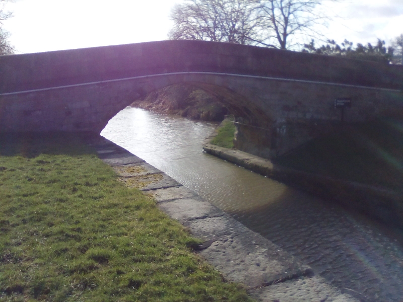
Paper House Bridge
Canal bridge. Late C18. Millstone grit. Humpbacked bridge with one round
arch and low parapet with splayed ends terminating in round capped piers.
Spans the Selby Canal. Partly in the parish of Gateforth.
Listing NGR: SE5731527543
External links are from the relevant listing authority and, where applicable, Wikidata. Wikidata IDs may be related buildings as well as this specific building. If you want to add or update a link, you will need to do so by editing the Wikidata entry.


Other nearby listed buildings
