Approximate Location Map
Large Map »
Latitude: 51.7483 / 51°44'53"N
Longitude: -0.3377 / 0°20'15"W
OS Eastings: 514849
OS Northings: 206820
OS Grid: TL148068
Mapcode National: GBR H89.CDX
Mapcode Global: VHGPQ.3B92
Plus Code: 9C3XPMX6+8W
Entry Name: 79, Sopwell Lane
Listing Date: 27 August 1971
Grade: II
Source: Historic England
Source ID: 1174501
English Heritage Legacy ID: 163451
ID on this website: 101174501
Location: St Albans, St. Albans, Hertfordshire, AL1
County: Hertfordshire
District: St. Albans
Electoral Ward/Division: St Peters
Parish: Non Civil Parish
Built-Up Area: St Albans
Traditional County: Hertfordshire
Lieutenancy Area (Ceremonial County): Hertfordshire
Church of England Parish: Abbey Parish of St Albans
Church of England Diocese: St.Albans
Tagged with: Building
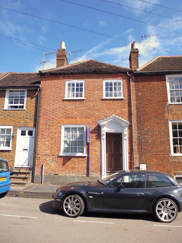
SOPWELL LANE
1. (North Side)
1582
No 79
TL 1406 NE 14/116
II
2.
Earlier C18 house of 2 storeys, 2 windows. Moderately high pitched,
hipped, tiled roof. Cement rendered front with low plinth. Shallow
segmental arches to near-flush windows in box frames, casements on 1st
floor, sashes on ground floor, both with glazing bars. 6-panel door
in wood doorcase that has bracketed open pediment with dentil cornice.
Listing NGR: TL1484906820
External links are from the relevant listing authority and, where applicable, Wikidata. Wikidata IDs may be related buildings as well as this specific building. If you want to add or update a link, you will need to do so by editing the Wikidata entry.


Other nearby listed buildings
