Latitude: 52.5349 / 52°32'5"N
Longitude: -2.4237 / 2°25'25"W
OS Eastings: 371355
OS Northings: 293093
OS Grid: SO713930
Mapcode National: GBR BZ.FD13
Mapcode Global: VH83H.YK12
Plus Code: 9C4VGHMG+XG
Entry Name: 18 and 19, Pound Street
Listing Date: 1 February 1974
Grade: II
Source: Historic England
Source ID: 1177851
English Heritage Legacy ID: 254494
ID on this website: 101177851
Location: High Town, Shropshire, WV16
County: Shropshire
Civil Parish: Bridgnorth
Built-Up Area: Bridgnorth
Traditional County: Shropshire
Lieutenancy Area (Ceremonial County): Shropshire
Church of England Parish: Bridgnorth
Church of England Diocese: Hereford
Tagged with: Building
1.
1954
SO 79 SW
2/166
BRIDGNORTH
POUND STREET
Nos 18 and 19
II
2.
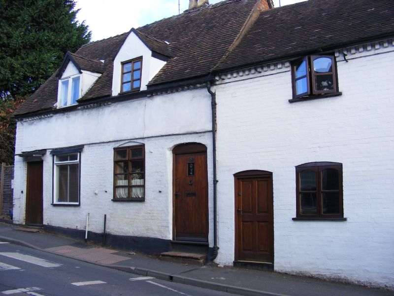
Early C19 painted brick and plaster to earlier timber frame; single storey
and attic; canted bay window with glazing bars and 1 casement window with
shutters; 1 simple doorway; 2 timber framed and plaster dormers; dentilled
eaves; tiles.
Listing NGR: SO7135593093
External links are from the relevant listing authority and, where applicable, Wikidata. Wikidata IDs may be related buildings as well as this specific building. If you want to add or update a link, you will need to do so by editing the Wikidata entry.


Other nearby listed buildings