Latitude: 52.8049 / 52°48'17"N
Longitude: -1.1058 / 1°6'20"W
OS Eastings: 460376
OS Northings: 323416
OS Grid: SK603234
Mapcode National: GBR 9LW.37C
Mapcode Global: WHDHK.ZRLJ
Plus Code: 9C4WRV3V+XM
Entry Name: 9, Church Street
Listing Date: 15 March 1984
Grade: II
Source: Historic England
Source ID: 1178101
English Heritage Legacy ID: 189342
ID on this website: 101178101
Location: Wymeswold, Charnwood, Leicestershire, LE12
County: Leicestershire
District: Charnwood
Civil Parish: Wymeswold
Built-Up Area: Wymeswold
Traditional County: Leicestershire
Lieutenancy Area (Ceremonial County): Leicestershire
Church of England Parish: Wymeswold St Mary
Church of England Diocese: Leicester
Tagged with: Building
This list entry was subject to a Minor Amendment on 10 April 2025 to update the Name and Address and reformat the text to current standards
SK 6023 - 6123
2/84
WYMESWOLD
CHURCH STREET (West side)
No 9
(Formerly listed as No. 11)
GV
II
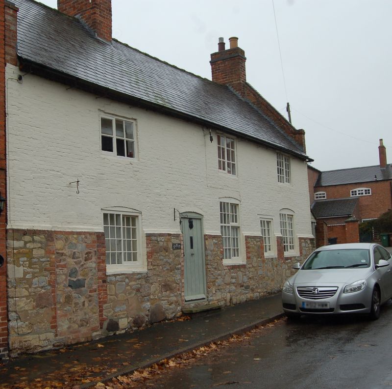
House, possibly formerly barn. Brick on a deep rubble plinth, with steeply coped gables. Four bays, two storeys. Irregular fenestration. Doorway to left, then a window,both with cambered heads. Then a blocked door, a tall segmental headed window, and two horizontal sliding sashes. Three windows above. Axial and right-hand gable stacks. On the main facade are various blocked openings which appear to represent former ventilation slits, and to the rear is a large, blocked arched opening.
Listing NGR: SK6037623416
External links are from the relevant listing authority and, where applicable, Wikidata. Wikidata IDs may be related buildings as well as this specific building. If you want to add or update a link, you will need to do so by editing the Wikidata entry.


Other nearby listed buildings