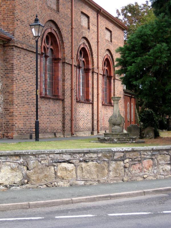
Latitude: 52.8745 / 52°52'28"N
Longitude: -3.0027 / 3°0'9"W
OS Eastings: 332608
OS Northings: 331254
OS Grid: SJ326312
Mapcode National: GBR 75.QWNC
Mapcode Global: WH89X.V0BN
Plus Code: 9C4RVXFW+RW
Entry Name: Sundial Approximately 3 Metres South of Nave of Church of St John the Baptist
Listing Date: 2 September 1987
Grade: II
Source: Historic England
Source ID: 1178358
English Heritage Legacy ID: 255838
ID on this website: 101178358
Location: St John the Baptist's Church, Whittington, Shropshire, SY11
County: Shropshire
Civil Parish: Whittington
Built-Up Area: Whittington
Traditional County: Shropshire
Lieutenancy Area (Ceremonial County): Shropshire
Church of England Parish: Whittington St John the Baptist
Church of England Diocese: Lichfield
Tagged with: Sundial
WHITTINGTON C.P. CHURCH STREET (east side) SJ 3231-3331 11/122 Sundial approx. 3m south of nave of Church of St John the Baptist GV II Sundial. Early C19. Sandstone. Vase-shaped baluster with moulded plinth and capping on base of 3 circular steps. Said to have been made by S. Whitford of London and to have been inscribed with his name and that of John Rasbrook of Whittington, neither name decipherable at time of resurvey (June 1986). D.H.S. Cranage, The Churches of Shropshire, Part 9 (1908), p. 837.
Listing NGR: SJ3260831254
External links are from the relevant listing authority and, where applicable, Wikidata. Wikidata IDs may be related buildings as well as this specific building. If you want to add or update a link, you will need to do so by editing the Wikidata entry.


Other nearby listed buildings