Latitude: 51.8992 / 51°53'57"N
Longitude: -2.7954 / 2°47'43"W
OS Eastings: 345367
OS Northings: 222597
OS Grid: SO453225
Mapcode National: GBR FG.QK7C
Mapcode Global: VH78Y.HJJD
Plus Code: 9C3VV6X3+MR
Entry Name: Milepost About 20 Yards East of Baptist Chapel
Listing Date: 30 April 1986
Grade: II
Source: Historic England
Source ID: 1178709
English Heritage Legacy ID: 155175
ID on this website: 101178709
Location: Garway, County of Herefordshire, HR2
County: County of Herefordshire
Civil Parish: Garway
Traditional County: Herefordshire
Lieutenancy Area (Ceremonial County): Herefordshire
Church of England Parish: Garway
Church of England Diocese: Hereford
Tagged with: Milestone
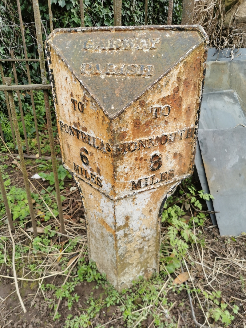
GARWAY CP -
SO 42 SE
5/19 Milepost about 20 yards
east of Baptist Chapel
GV II
Milepost. Probably mid-C19. Cast iron with angled top and sides rising
from curved angled base. Raised lettering:
GARWAY
PARISH
TO TO
PONTRILAS MONMOUTH
6 8
MILES MILES
Listing NGR: SO4536722597
External links are from the relevant listing authority and, where applicable, Wikidata. Wikidata IDs may be related buildings as well as this specific building. If you want to add or update a link, you will need to do so by editing the Wikidata entry.


Other nearby listed buildings