Latitude: 52.2722 / 52°16'19"N
Longitude: -2.0866 / 2°5'11"W
OS Eastings: 394188
OS Northings: 263785
OS Grid: SO941637
Mapcode National: GBR 2GP.F9J
Mapcode Global: VH92H.S48Z
Plus Code: 9C4V7WC7+V9
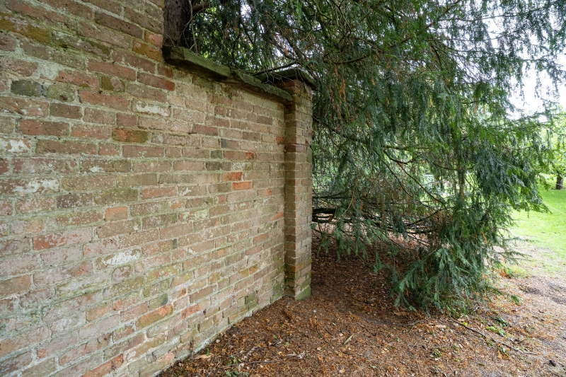
Entry Name: Garden Wall About 250 Yards North-West of Hanbury Hall
Listing Date: 4 September 1986
Grade: II
Source: Historic England
Source ID: 1179772
English Heritage Legacy ID: 147808
ID on this website: 101179772
Location: Wychavon, Worcestershire, WR9
County: Worcestershire
District: Wychavon
Civil Parish: Hanbury
Traditional County: Worcestershire
Lieutenancy Area (Ceremonial County): Worcestershire
Church of England Parish: Hanbury
Church of England Diocese: Worcester
Tagged with: Wall
HANBURY CP SCHOOL ROAD (north side) SO 96 SW 3/132 Garden wall about 250 yards north-west of Hanbury Hall
GV II Garden wall. Late C18. Brick in English garden wall bond with sandstone coping. About 10 feet high and 40 yards long on a south-west/north-east axis with a south-west return about 5 yards long terminating in a square pier with pyramidal capping. The wall was part of a former walled garden of which one other section survives attached to another, complete walled garden (qv). Both gardens retain their orchards. Included as part of the garden layout of Hanbury Hall (qv).
Listing NGR: SO9418863785
External links are from the relevant listing authority and, where applicable, Wikidata. Wikidata IDs may be related buildings as well as this specific building. If you want to add or update a link, you will need to do so by editing the Wikidata entry.


Other nearby listed buildings