Latitude: 51.1044 / 51°6'15"N
Longitude: 0.1564 / 0°9'22"E
OS Eastings: 551063
OS Northings: 136111
OS Grid: TQ510361
Mapcode National: GBR LNP.QBH
Mapcode Global: VHHQJ.NHJQ
Plus Code: 9F324534+QG
Entry Name: Hunt's Farmhouse
Listing Date: 26 November 1953
Grade: II
Source: Historic England
Source ID: 1180492
English Heritage Legacy ID: 296903
ID on this website: 101180492
Location: Wealden, East Sussex, TN7
County: East Sussex
District: Wealden
Civil Parish: Withyham
Traditional County: Sussex
Lieutenancy Area (Ceremonial County): East Sussex
Church of England Parish: Withyham St Michael and All Angels
Church of England Diocese: Chichester
Tagged with: Farmhouse
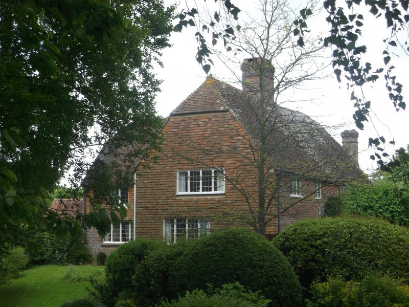
WITHYHAM Hunt's Farmhouse
1.
5208
TQ 53 NW 6/156 26.11.53
II
2.
L-shaped C17 house. Two storeys. Three windows. Partly red brick and grey
headers, partly tile-hung. Tiled roof. Casement windows. South wing has
a half-hipped gable with attic window.
Listing NGR: TQ5106336111
External links are from the relevant listing authority and, where applicable, Wikidata. Wikidata IDs may be related buildings as well as this specific building. If you want to add or update a link, you will need to do so by editing the Wikidata entry.


Other nearby listed buildings