Latitude: 51.4792 / 51°28'45"N
Longitude: -0.923 / 0°55'22"W
OS Eastings: 474888
OS Northings: 176130
OS Grid: SU748761
Mapcode National: GBR QY5.Q6
Mapcode Global: VHDWT.Y2DW
Plus Code: 9C3XF3HG+MQ
Entry Name: The Centuries
Listing Date: 24 October 1951
Grade: II
Source: Historic England
Source ID: 1180954
English Heritage Legacy ID: 247083
ID on this website: 101180954
Location: Sonning Eye, South Oxfordshire, RG4
County: Oxfordshire
District: South Oxfordshire
Civil Parish: Eye and Dunsden
Traditional County: Oxfordshire
Lieutenancy Area (Ceremonial County): Oxfordshire
Church of England Parish: Sonning
Church of England Diocese: Oxford
Tagged with: Architectural structure
EYE AND DUNSDEN SONNING EYE
SU77NW
9/62 The Centuries
24/10/51
- II
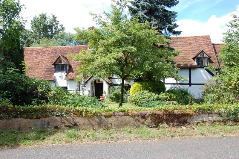
House. C18 with C19 alterations. Irregular timber-frame with painted brick
infill; plain tile roof; brick ridge stacks. Gabled porch to left of
centre with glazed C20 door. Three C19 metal casements. 3 dormers, with
C19 gothick casements.
Listing NGR: SU7488876130
External links are from the relevant listing authority and, where applicable, Wikidata. Wikidata IDs may be related buildings as well as this specific building. If you want to add or update a link, you will need to do so by editing the Wikidata entry.


Other nearby listed buildings