Latitude: 51.1939 / 51°11'38"N
Longitude: -2.0189 / 2°1'8"W
OS Eastings: 398774
OS Northings: 143853
OS Grid: ST987438
Mapcode National: GBR 2WY.0DJ
Mapcode Global: VHB56.Y8K3
Plus Code: 9C3V5XVJ+HC
Entry Name: The Round House
Listing Date: 11 December 1987
Grade: II
Source: Historic England
Source ID: 1181002
English Heritage Legacy ID: 313509
ID on this website: 101181002
Location: Chitterne, Wiltshire, BA12
County: Wiltshire
Civil Parish: Chitterne
Built-Up Area: Chitterne
Traditional County: Wiltshire
Lieutenancy Area (Ceremonial County): Wiltshire
Church of England Parish: Salisbury Plain
Church of England Diocese: Salisbury
Tagged with: House
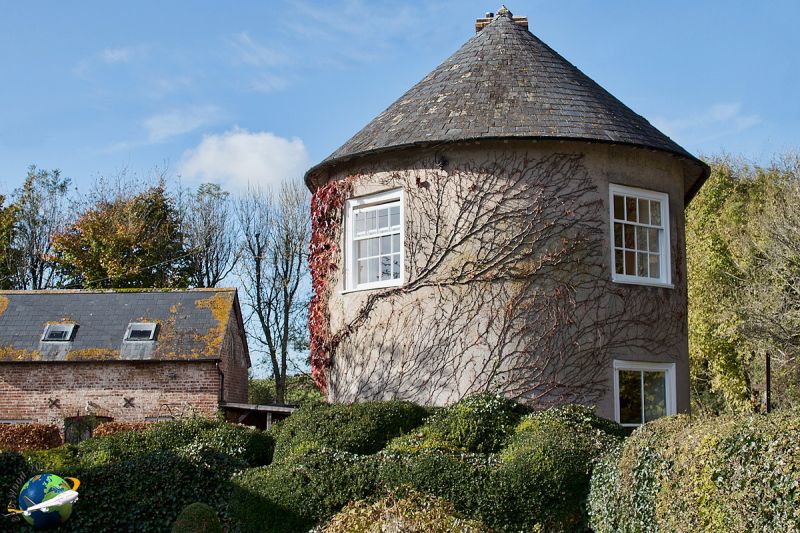
CHITTERNE WARMINSTER ROAD ST 94 SE (south side) 4/36 No 109 (The Round House) GV II Detached house. Late C17, extended early C19. Rendered chalk, flint and brick rubble stone, Welsh slate roof with brick stack. Entrance away from road; 2-storey, 4-window south front. Four- panelled door to right of centre, C20 door in former window to left, 4-pane sash to right, first floor has three 2-light segmental-headed casements to left and single-light first floor casement. Right hand bay is early C19 addition with semi-circular east end to right return: 4-pane sash to ground floor, 2-light casement and 4-pane wide 12-pane sash to first floor. Rear, facing road has 2-light segmental-headed casement and C20 casements to ground floor, C20 casement and pointed casement with interlaced glazing bars to first floor. C20 bay added to west end in similar style. Interior has partly blocked open fireplace with raised timber lintel on brick jambs in kitchen. Early C19 drawing room in curved east end has reeded door and window architraves with paterae, door with 6 reeded panels, window shutters with reeded panels. This may have originated as a small single-cell cottage, addition of early C19 bay with unusual curved end possibly indicates that this may have been used as a toll cottage on the turnpike to Amesbury.
Listing NGR: ST9877443853
External links are from the relevant listing authority and, where applicable, Wikidata. Wikidata IDs may be related buildings as well as this specific building. If you want to add or update a link, you will need to do so by editing the Wikidata entry.


Other nearby listed buildings