Latitude: 51.2089 / 51°12'32"N
Longitude: -1.9169 / 1°55'0"W
OS Eastings: 405898
OS Northings: 145528
OS Grid: SU058455
Mapcode National: GBR 3Y6.268
Mapcode Global: VHB52.QWG3
Plus Code: 9C3W635M+H6
Entry Name: Hunter's Moon
Listing Date: 4 July 1985
Grade: II
Source: Historic England
Source ID: 1181869
English Heritage Legacy ID: 319826
ID on this website: 101181869
Location: Orcheston, Wiltshire, SP3
County: Wiltshire
Civil Parish: Orcheston
Built-Up Area: Orcheston
Traditional County: Wiltshire
Lieutenancy Area (Ceremonial County): Wiltshire
Church of England Parish: Salisbury Plain
Church of England Diocese: Salisbury
Tagged with: Architectural structure
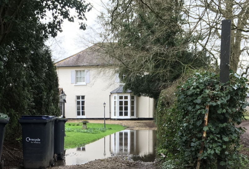
ORCHESTON ORCHESTON ST. MARY SU 04 NE (west side) ) 2/190 Hunter's Moon GV II Detached house. Second quarter C19. Flemish bond brick, Welsh slate hipped roof, brick stacks. Entrance front at right angles to road; 2-storey, 2-window. Central door has two round-arched panels, and fanlight over, to right is 16-pane sash, first floor has one 2-light casement and round-arched sash to right. Left return faces road; to right is canted bay with French windows, plain French windows to left, first floor has two 6-pane sashes with shutters, flanking the sides are pilasters with simple brick capitals (compare with garden front of Orcheston House q.v.), deep eaves to hipped roof. Rear has 6-pane sashes and round-arched stair window, attached is late C19 2-storey extension. Interior not inspected. Included primarily for group value with Orcheston House (q.v.).
Listing NGR: SU0589845528
External links are from the relevant listing authority and, where applicable, Wikidata. Wikidata IDs may be related buildings as well as this specific building. If you want to add or update a link, you will need to do so by editing the Wikidata entry.


Other nearby listed buildings