Approximate Location Map
Large Map »
Latitude: 51.1721 / 51°10'19"N
Longitude: -1.7817 / 1°46'54"W
OS Eastings: 415357
OS Northings: 141449
OS Grid: SU153414
Mapcode National: GBR 503.DC9
Mapcode Global: VHB5C.2SFV
Plus Code: 9C3W56C9+R8
Entry Name: 6, Salisbury Street
Listing Date: 10 October 1988
Grade: II
Source: Historic England
Source ID: 1182661
English Heritage Legacy ID: 321380
ID on this website: 101182661
Location: Amesbury, Wiltshire, SP4
County: Wiltshire
Civil Parish: Amesbury
Built-Up Area: Amesbury
Traditional County: Wiltshire
Lieutenancy Area (Ceremonial County): Wiltshire
Church of England Parish: Amesbury St Mary and St Melor
Church of England Diocese: Salisbury
Tagged with: Building
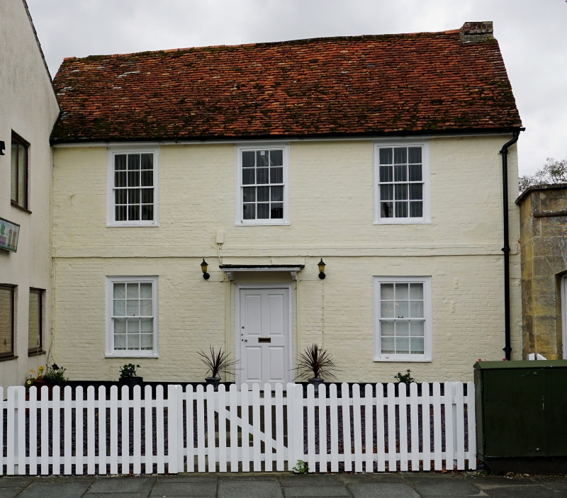
AMESBURY SALISBURY STREET
SU 1541
(west side)
11/69 No 6
II
House, now offices. 1750-1800. Colourwashed brick with tiled
roof. Two storeys, 3 bays. Central stair hall plan with outshut
to rear, former kitchen. Four panelled door with flat canopy on
cut brackets. Twelve-paned sash windows. Plat band. Stack to
right gable.
Listing NGR: SU1535741449
External links are from the relevant listing authority and, where applicable, Wikidata. Wikidata IDs may be related buildings as well as this specific building. If you want to add or update a link, you will need to do so by editing the Wikidata entry.


Other nearby listed buildings
