Latitude: 51.7529 / 51°45'10"N
Longitude: -1.0885 / 1°5'18"W
OS Eastings: 463017
OS Northings: 206413
OS Grid: SP630064
Mapcode National: GBR B0P.1LZ
Mapcode Global: VHCXY.26XL
Plus Code: 9C3WQW36+5J
Entry Name: Waterperry House, Garden Bridge Approximately 150 Metres to North East
Listing Date: 5 June 1985
Grade: II
Source: Historic England
Source ID: 1182838
English Heritage Legacy ID: 246723
ID on this website: 101182838
Location: Waterperry Gardens, Waterperry, South Oxfordshire, OX33
County: Oxfordshire
District: South Oxfordshire
Civil Parish: Waterperry with Thomley
Traditional County: Oxfordshire
Lieutenancy Area (Ceremonial County): Oxfordshire
Church of England Parish: Waterperry
Church of England Diocese: Oxford
Tagged with: Architectural structure
WATERPERRY SP60NW 6/203 Waterperry House, garden bridge approx. 150m. to NE
- II
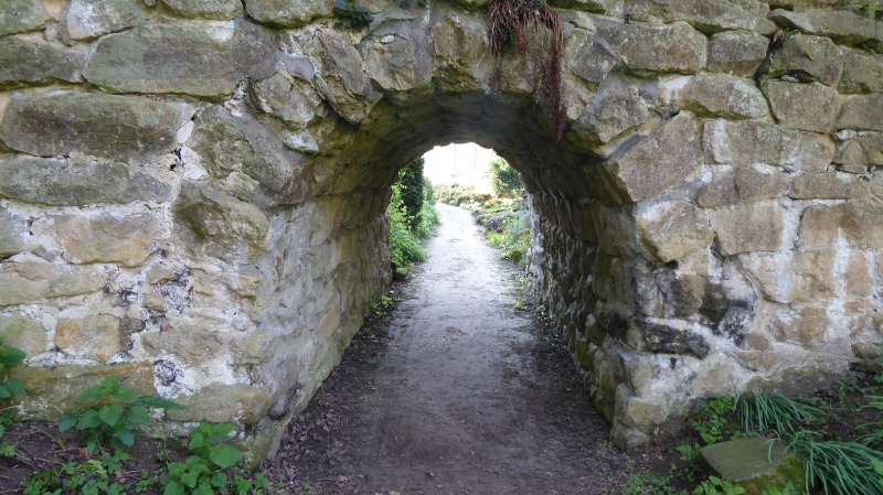
Garden bridge. C18. Limestone ashlar and coursed squared rubble; brick interior. Ashlar central section has 4 Doric half-columns supporting a triglyph entablature; the outer bays have round-headed niches which flank the central round-headed entrance and a projecting tablet. Rubble abutments. Rear is of rubble, with squared quoins and cornice to the central section which breaks forward slightly. Central entrance has wide round-arched surround in heavy chamfered rustication, Interior: Tunnel has central octagonal chamber with saucer vault. The front now forms the background to a small amphitheatre but the tunnel formerly formed part of a sunken walk.
Listing NGR: SP6301706413
External links are from the relevant listing authority and, where applicable, Wikidata. Wikidata IDs may be related buildings as well as this specific building. If you want to add or update a link, you will need to do so by editing the Wikidata entry.


Other nearby listed buildings