Approximate Location Map
Large Map »
Latitude: 51.6106 / 51°36'38"N
Longitude: 0.0452 / 0°2'42"E
OS Eastings: 541709
OS Northings: 192178
OS Grid: TQ417921
Mapcode National: GBR MG.423
Mapcode Global: VHHMY.QSQ5
Plus Code: 9F32J26W+63
Entry Name: Garden Walls at Ray House
Listing Date: 22 February 1979
Grade: II
Source: Historic England
Source ID: 1183590
English Heritage Legacy ID: 204872
ID on this website: 101183590
Location: Ray Park, Woodford, Redbridge, London, IG8
County: London
District: Redbridge
Electoral Ward/Division: Bridge
Parish: Non Civil Parish
Built-Up Area: Redbridge
Traditional County: Essex
Lieutenancy Area (Ceremonial County): Greater London
Church of England Parish: Woodford Green St Barnabas
Church of England Diocese: Chelmsford
Tagged with: Wall
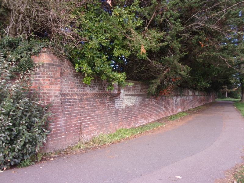
SNAKES LANE
1.
5027
Woodford
Garden walls at
Ray House
TQ 4192 7/12
II
2.
C18. Tall plum brick walls of octagonal walled garden.
Listing NGR: TQ4170992178
External links are from the relevant listing authority and, where applicable, Wikidata. Wikidata IDs may be related buildings as well as this specific building. If you want to add or update a link, you will need to do so by editing the Wikidata entry.


Other nearby listed buildings
