Latitude: 50.9926 / 50°59'33"N
Longitude: -1.7426 / 1°44'33"W
OS Eastings: 418164
OS Northings: 121500
OS Grid: SU181215
Mapcode National: GBR 528.Q89
Mapcode Global: FRA 767H.8Y1
Plus Code: 9C2WX7V4+2X
Entry Name: 32 and 34, High Street
Listing Date: 4 July 1985
Grade: II
Source: Historic England
Source ID: 1183630
English Heritage Legacy ID: 319657
ID on this website: 101183630
Location: Downton, Wiltshire, SP5
County: Wiltshire
Civil Parish: Downton
Built-Up Area: Downton
Traditional County: Wiltshire
Lieutenancy Area (Ceremonial County): Wiltshire
Church of England Parish: Downton St Lawrence
Church of England Diocese: Salisbury
Tagged with: Building
DOWNTON HIGH STREET SU 1821 ( south side) 6/98 Nos 32 and 34
GV II
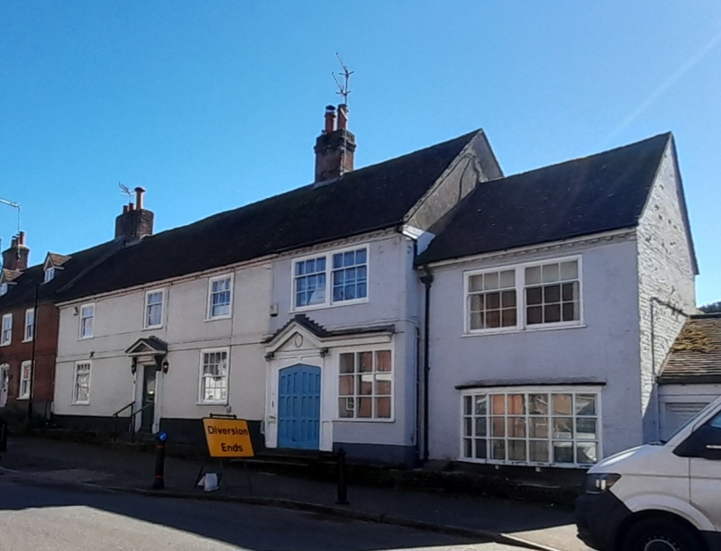
House and shop at end of row. Early C17, C18 refacing of front. Painted irregular Flemish bond brick, tiled roof, brick stacks. 2- storey, 4-window. C20 door with pediment on pilasters, 16-pane sash to either side, C20 shop front to right. First floor has three 9-pane sashes and one pair of 9-pane sashes to right. Dentilled eaves. Attached to right is late C18 extension with C20 bow window and pair of 9-pane sashes to first floor. Right return is windowless. Rear not accessible. Interior said to have chamfered beams and exposed chamfered joists, open fireplace with chamfered lintel. Early C17 timber-framing, faced with brick in C18. (Unpublished records of RCHM (England), Salisbury)
Listing NGR: SU1816021502
External links are from the relevant listing authority and, where applicable, Wikidata. Wikidata IDs may be related buildings as well as this specific building. If you want to add or update a link, you will need to do so by editing the Wikidata entry.


Other nearby listed buildings