Latitude: 51.561 / 51°33'39"N
Longitude: 0.2246 / 0°13'28"E
OS Eastings: 554302
OS Northings: 187028
OS Grid: TQ543870
Mapcode National: GBR V8.79J
Mapcode Global: VHHNF.V134
Plus Code: 9F32H66F+CR
Entry Name: Wykham Cottage
Listing Date: 14 September 1979
Last Amended: 2 May 1980
Grade: II
Source: Historic England
Source ID: 1183788
English Heritage Legacy ID: 201590
ID on this website: 101183788
Location: Hornchurch, Havering, London, RM12
County: London
District: Havering
Electoral Ward/Division: St Andrew's
Parish: Non Civil Parish
Built-Up Area: Havering
Traditional County: Essex
Lieutenancy Area (Ceremonial County): Greater London
Church of England Parish: Hornchurch St Andrew
Church of England Diocese: Chelmsford
Tagged with: Cottage
In the entry for HIGH STREET 10/16 Hornchurch Nos 218 to 220 (Wykham Cottage) the address shall be amended to read:
HIGH STREET Hornchurch No 218 (Wykham Cottage)
------------------------------------
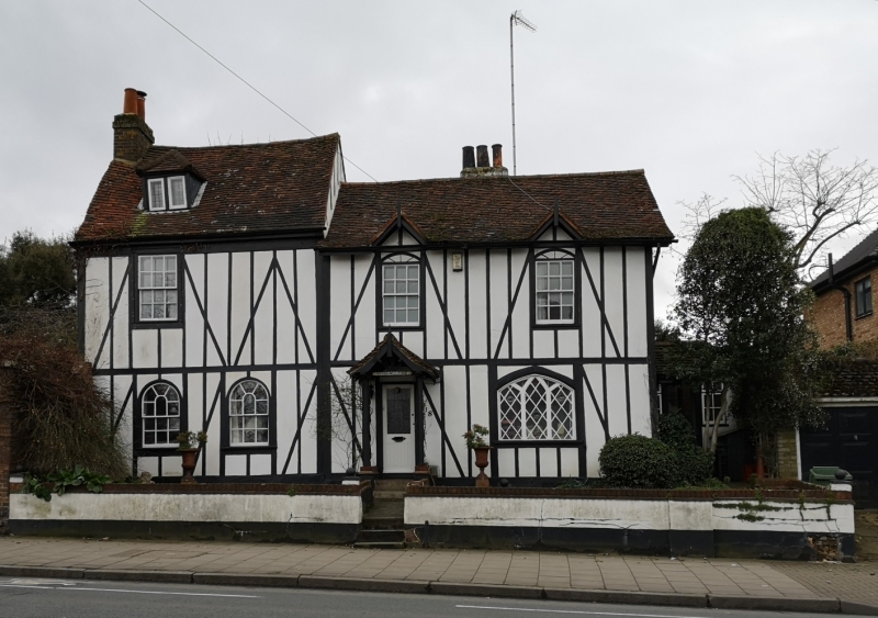
HIGH STREET 1. 5107 Hornchurch Nos 218 and 220 (Wykham Cottage) TQ 58 NW 10/16 II 2. C18 timber-framed cottage, with C19 extensions. Rendered with applied timber-framing on front elevation. Two storeys 4 bays, with dormer at the east end. Two semi-circular headed windows, the west one a modern insertion replacing an original door. One square headed window above. Door now in 2nd bay from the west, with further door on western return elevation. Western window of front has depressed pointed arch with simple tracery 2 square headed windows above. End stack at east, rear stack at west. Old tile roof lower pitch to the western end, slate.
Listing NGR: TQ5430287028
External links are from the relevant listing authority and, where applicable, Wikidata. Wikidata IDs may be related buildings as well as this specific building. If you want to add or update a link, you will need to do so by editing the Wikidata entry.


Other nearby listed buildings