Approximate Location Map
Large Map »
Latitude: 51.5616 / 51°33'41"N
Longitude: 0.2227 / 0°13'21"E
OS Eastings: 554164
OS Northings: 187082
OS Grid: TQ541870
Mapcode National: GBR V8.6SQ
Mapcode Global: VHHNF.T02R
Plus Code: 9F32H66F+J3
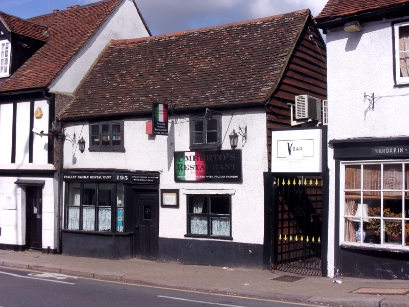
Entry Name: 195, High Street
Listing Date: 10 April 1975
Grade: II
Source: Historic England
Source ID: 1358530
English Heritage Legacy ID: 201588
ID on this website: 101358530
Location: Hornchurch, Havering, London, RM11
County: London
District: Havering
Electoral Ward/Division: St Andrew's
Parish: Non Civil Parish
Built-Up Area: Havering
Traditional County: Essex
Lieutenancy Area (Ceremonial County): Greater London
Church of England Parish: Hornchurch St Andrew
Church of England Diocese: Chelmsford
Tagged with: Building
HIGH STREET
1.
5107
Hornchurch
No 195
TQ 58 NW 10/13 10.4.75
II GV
2.
C17 house; timber-framed roughcast, 2 storeys, 2 bays, rear outshot. Old
tile roof, small shop-front to ground floor.
Listing NGR: TQ5416587083
External links are from the relevant listing authority and, where applicable, Wikidata. Wikidata IDs may be related buildings as well as this specific building. If you want to add or update a link, you will need to do so by editing the Wikidata entry.


Other nearby listed buildings
