Latitude: 53.7146 / 53°42'52"N
Longitude: -1.4662 / 1°27'58"W
OS Eastings: 435325
OS Northings: 424376
OS Grid: SE353243
Mapcode National: GBR LT6H.C4
Mapcode Global: WHDBY.GW0P
Plus Code: 9C5WPG7M+RG
Entry Name: Nos 12A, 14, 16, 18 and 20, Including Attached Gate Piers to Left
Listing Date: 17 June 1982
Last Amended: 6 May 1988
Grade: II
Source: Historic England
Source ID: 1184466
English Heritage Legacy ID: 342549
ID on this website: 101184466
Location: Bottom Boat, Wakefield, West Yorkshire, WF3
County: Wakefield
Electoral Ward/Division: Stanley and Outwood East
Parish: Non Civil Parish
Built-Up Area: Wakefield
Traditional County: Yorkshire
Lieutenancy Area (Ceremonial County): West Yorkshire
Church of England Parish: Stanley St Peter
Church of England Diocese: Leeds
Tagged with: Building
SE32SE STANLEY LAKE YARD (south side), Lake Lock
5/56 Nos 12A, 14, 16, 18 and 17.6.82 20, including attached gate piers to left. (formerly listed as Aire and Calder Navigation Depot).
- II
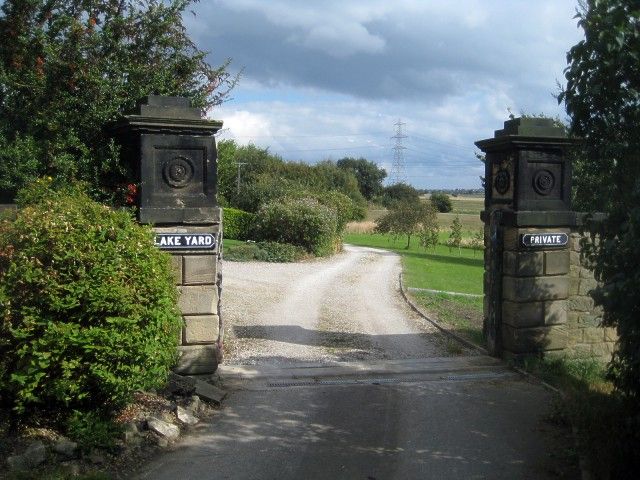
Former canal navigation cottages and workshops, now 5 dwellings. 1802 for the Aire and Calder Navigation Company. Altered 1980s. Coursed squared stone. Stone and Welsh slate roofs. A symmetrical arrangement of buildings consisting of a 3-bay central house breaking forward slightly from the flanking 6-bay cottages. The former 7-bay workshops are set back to each side, with 9- and 7-bay cartsheds attached to left and right respectively. Two storeys. Central door to centre house, 2 symmetrically-placed doors to each of the slightly lower 6-bay ranges (each formerly 2 cottages) all with overlights. Mainly 4-pane or 12-pane sash windows, some casements with glazing bars. Openings have plain raised surrounds. End stacks to centre house. The former workshop ranges each have a large central, segmental- headed cart entry (now glazed) with a small round-arched former loading door above (now a window), all these in alternately blocked raised surrounds. Windows are similar to before. Loading door to 1st floor, inner end in each case, the stone steps now removed. Hipped roofs. The cart sheds have cylindrical stone piers with square caps, those to right now glazed. Mono- pitched roofs. Attached to the left cart shed is a pair of square rusticated ashlar gatepiers with a monolithic upper part with a sunk panel containing a roundel. Moulded cornice with guttae and blocking course.
Listing NGR: SE3532524376
External links are from the relevant listing authority and, where applicable, Wikidata. Wikidata IDs may be related buildings as well as this specific building. If you want to add or update a link, you will need to do so by editing the Wikidata entry.


Other nearby listed buildings