Latitude: 52.0381 / 52°2'17"N
Longitude: -1.4869 / 1°29'12"W
OS Eastings: 435291
OS Northings: 237864
OS Grid: SP352378
Mapcode National: GBR 6RP.2XH
Mapcode Global: VHBYX.51SG
Plus Code: 9C4W2GQ7+66
Entry Name: Gower's Close
Listing Date: 20 September 1988
Grade: II
Source: Historic England
Source ID: 1184538
English Heritage Legacy ID: 244729
ID on this website: 101184538
Location: Sibford Gower, Cherwell, Oxfordshire, OX15
County: Oxfordshire
District: Cherwell
Civil Parish: Sibford Gower
Built-Up Area: Sibford Gower
Traditional County: Oxfordshire
Lieutenancy Area (Ceremonial County): Oxfordshire
Church of England Parish: Sibford
Church of England Diocese: Oxford
Tagged with: Architectural structure Thatched cottage
SIBF0RD GOWER BURDROP ROAD SP3436-3536 (South side) 16/172 Gower's Close
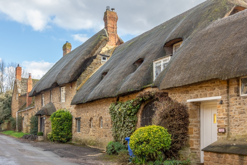
House. 2 parts. Left part early to mid C18. Right part C16/C17. Later alterations. Left part. Coursed ironstone rubble. Steeply pitched thatched roof. Brick end stack. 2-unit plan. 2 storeys. 3-window range. Approximately central entrance has C20 thatched porch, flanked by blocked fixed-light windows with c20 pointed arched heads. First floor has a single light and two 2-light wood mullioned and transomed windows with wood lintels. Right part. Single storey plus attic. Ground floor has arched garage entrance on right and 3 small C20 pointed windows and a C20 window. Attic has 3 eyebrow dormers and a large dormer. Interior: wide inglenook fireplace with chamfered bressumer and bread oven. Chamfered spine beam. Partly original roof with principal and common rafters and collars.
Listing NGR: SP3529137864
External links are from the relevant listing authority and, where applicable, Wikidata. Wikidata IDs may be related buildings as well as this specific building. If you want to add or update a link, you will need to do so by editing the Wikidata entry.


Other nearby listed buildings