Latitude: 52.3435 / 52°20'36"N
Longitude: -1.6649 / 1°39'53"W
OS Eastings: 422926
OS Northings: 271761
OS Grid: SP229717
Mapcode National: GBR 5LF.5VM
Mapcode Global: VHBX8.3C6C
Plus Code: 9C4W88VP+92
Entry Name: Wroxall Manor Farmhouse
Listing Date: 16 February 1990
Grade: II
Source: Historic England
Source ID: 1184632
English Heritage Legacy ID: 308391
ID on this website: 101184632
Location: Wroxall, Warwick, Warwickshire, CV35
County: Warwickshire
District: Warwick
Civil Parish: Beausale, Haseley, Honiley and Wroxall
Traditional County: Warwickshire
Lieutenancy Area (Ceremonial County): Warwickshire
Church of England Parish: Honiley St John the Baptist
Church of England Diocese: Coventry
Tagged with: Farmhouse
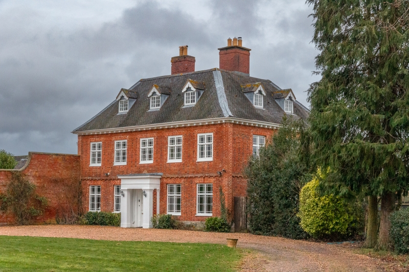
WROXALL SP27SW 2/25 Wroxall Manor Farmhouse II Farmhouse. Probably late C17, with C19 alterations. Stone plinth; red brick with flared headers in Flemish bond; old fishscale-tile hipped roof; brick internal stacks to left and right. 2 storeys and attic; 5-window range. Sash door to centre with C19 Doric rendered flat-roofed porch. C19 wood cross-windows with decorative glazing bars to ground floor left of centre and right of centre, and to first floor. Blocked windows to ground floor left and right; all have painted surrounds. Brick dentil eaves. Two C19 gabled dormers with 2-light casements. Interior not inspected. [ 126]
Listing NGR: SP2292671761
External links are from the relevant listing authority and, where applicable, Wikidata. Wikidata IDs may be related buildings as well as this specific building. If you want to add or update a link, you will need to do so by editing the Wikidata entry.


Other nearby listed buildings