Latitude: 54.9683 / 54°58'5"N
Longitude: -1.5192 / 1°31'9"W
OS Eastings: 430875
OS Northings: 563848
OS Grid: NZ308638
Mapcode National: GBR KBTZ.WS
Mapcode Global: WHC3S.MDR2
Plus Code: 9C6WXF9J+88
Entry Name: Mortuary Gateway and Chapels in Hebburn Cemetery
Listing Date: 26 February 1985
Grade: II
Source: Historic England
Source ID: 1185874
English Heritage Legacy ID: 303742
ID on this website: 101185874
Location: Hebburn Cemetery, Hebburn, South Tyneside, Tyne and Wear, NE31
County: South Tyneside
Electoral Ward/Division: Hebburn South
Parish: Non Civil Parish
Built-Up Area: Hebburn
Traditional County: Durham
Lieutenancy Area (Ceremonial County): Tyne and Wear
Church of England Parish: Hebburn St John
Church of England Diocese: Durham
Tagged with: Funeral home
NZ 36SW HEBBURN VICTORIA ROAD WEST (east side)
2/81 Mortuary gateway and chapels in Hebburn Cemetery -
GV II
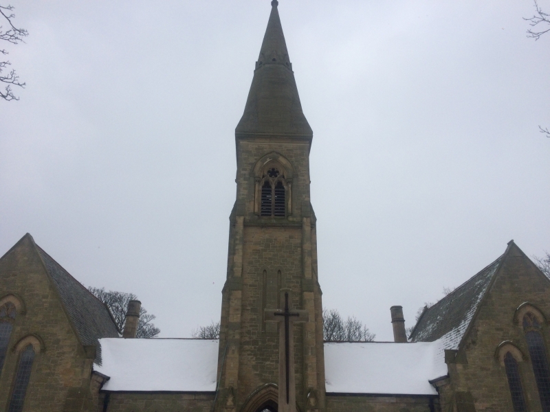
Linked pair of chapels. 1890 by Frederick West, surveyor to Hedworth, Monkton and Jarrow Burial Board. Snecked sandstone with ashlar dressings; roof of Welsh slate. Early English style, H-shaped plan. Tower with tall stone spire over carriage arch has narrow lancets at first and open 2-light windows at second stage. In arch are doors to corridors of 3 windows leading to chapels. East elevations have 3 tall cusped lancets, the central with flowing tracery; hood moulds with flower stops; buttresses and angle buttresses with gablets and coping to set-backs. Roof of corridor has red-tiled ridge; the chapel roofs high-pitched with stone gable coping; 2 ashlar chimneys.
Listing NGR: NZ3087563848
External links are from the relevant listing authority and, where applicable, Wikidata. Wikidata IDs may be related buildings as well as this specific building. If you want to add or update a link, you will need to do so by editing the Wikidata entry.


Other nearby listed buildings